Taxkorgan Tajik Autonomous County
|
Taxkorgan County 塔什库尔干县 • Toxkhürghon Tujik Oftunum Noya • تاشقۇرغان ناھىيىسى (Chinese) • (Sariquli Tajik) • (Uyghur) |
|
|---|---|
| Autonomous county | |
|
Taxkorgan Tajik Autonomous County
塔什库尔干塔吉克自治县 تاشقۇرغان تاجیك ئاپتونوم ناھىيىسى Toxkhürghon Tujik Oftunum Noya |
|
 |
|
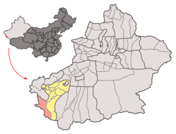
 Taxkorgan County (red) in Kashgar Prefecture (yellow) and Xinjiang |
|
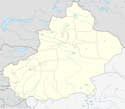
| Location of the seat in Xinjiang | |
| Coordinates: 37°46′N 75°13′E / 37.767°N 75.217°ECoordinates: 37°46′N 75°13′E / 37.767°N 75.217°E | |
| Country | China |
| Region | Xinjiang |
| Prefecture | Kashgar |
| County seat | Taxkorgan |
| Area | |
| • Total | 52,400 km2 (20,200 sq mi) |
| Elevation | 3,094 m (10,151 ft) |
| Population | |
| • Total | 30,000 |
| • Density | 0.57/km2 (1.5/sq mi) |
| Time zone | China Standard (UTC+8) |
| Postal code | 845250 |
| Area code(s) | 998 |
| Taxkorgan | |||||||||

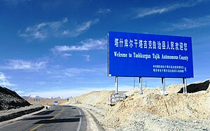
"Welcome to Tashkurgan Tajik Autonomous County"
|
|||||||||
| Chinese name | |||||||||
|---|---|---|---|---|---|---|---|---|---|
| Traditional Chinese | 塔什庫爾干塔吉克自治縣 | ||||||||
| Simplified Chinese | 塔什库尔干塔吉克自治县 | ||||||||
|
|||||||||
| Uyghur name | |||||||||
| Uyghur |
تاشقۇرغان تاجىك ئاپتونوم ناھىيىسى
|
||||||||
|
|||||||||
| Sarikoli name | |||||||||
| Sarikoli | Toxkhürghon Tujik Oftunum Noya | ||||||||
| Transcriptions | |
|---|---|
| Standard Mandarin | |
| Hanyu Pinyin | Tǎshíkù'ěrgàn Tǎjíkè Zìzhìxiàn |
| IPA | [tʰàʂɻ̩̌kʰûàɚ̯kân tʰàtɕǐkʰɤ̂ tsɹ̩̂ʈʂɻ̩̂ɕi̯ɛ̂n] |
| Transcriptions | |
|---|---|
| Latin Yëziqi | Tashqurghan Tajik Aptonom Nahiyisi |
| Yengi Yeziⱪ | Taxk̡urƣan Tajik Aptonom Nah̡iyisi |
| Siril Yëziqi | Tашқурған таҗик аптоном наһийиси |
TaxkorganTajik Autonomous County (sometimes spelled Tashkurgan or Tashkorgan) is a county of Kashgar Prefecture in western Xinjiang, China.
Taxkorgan County is located in the eastern part of the Pamir Plateau, where the Kunlun, Karakoram, Hindukush and Tian Shan mountains come together, at the borders with Afghanistan (Wakhan Corridor), Tajikistan (Gorno-Badakhshan Province) and Pakistan (Gilgit-Baltistan). The county seat is Taxkorgan Town.
The territorial expansion of the county is 178 kilometres (111 mi) from north to south, and 140 kilometres (87 mi) from east to west, the total area is about 52,400 square kilometres (20,200 sq mi), at an average altitude above 4,000 metres (13,000 ft). The county includes a significant part of the Trans-Karakoram Tract, disputed by India and Pakistan in the ongoing Kashmir conflict; while Pakistan has withdrawn the claim since 1963, India continues to claim it as part of the state of Jammu and Kashmir.
The Muztagh Ata, at 7,546 metres (24,757 ft), and the Kongur Tagh, at 7,719 metres (25,325 ft), are the main peaks in the county, while the two main rivers are the Taxkorgan River and the Tiznap (or Tiznef) River (Chinese: 提孜那甫河; pinyin: Tízīnàfǔ Hé). By including the Trans-Karakoram Tract, the county also borders several eight-thousanders, including K2, at 8,611 metres (28,251 ft) the second-highest mountain in the world. There are several hot springs and resources of gold, iron, and copper.
...
Wikipedia

