Surmali
| Surmalinsky Uyezd (in English) | ||
|---|---|---|
|
||
 |
||
|
||
| Established | 1849 | |
| Abolished | 1918 | |
| Political status | Uyezd | |
| Region | Caucasus | |
| Area | 3,241.0 verst² | |
| Population (1897 census) | ||
| • Total | 89055 | |
| • Density | 27.5 inhab. / verst² | |
| Government | ||
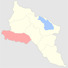
The Surmalinsky Uyezd (Russian: Сурмалинский уезд) or Surmali (Armenian: Սուրմալու Surmalu; Azerbaijani: Sürməli; Kurdish: Sûrmelî; Russian: Сурмали) was a county of the Erivan Governorate of the Caucasus Viceroyalty of the Russian Empire. It bordered the governorate's Echmiadzinsky and Erivansky Uyezds to the north, the Kars Oblast to the west, Persia to the east, and the Ottoman Empire to the south. It included most of the Iğdır Province of present-day Turkey. As part of Russian Transcaucasia, Surmali was significant as the location of Mount Ararat and the salt mines of Kulp (modern Tuzluca). Its administrative center was Igdyr.
"Surmali" derives from the name of the old Armenian city of "Surmari" which evolved from "Surb Mari" (Armenian: Սուրբ Մարի "Saint Mary"). The castle of Surmari still stands today in the village of Sürmeli on the Armenian border in the Tuzluca district of Turkey's Iğdır Province.
A part of Persia's Erivan Khanate, Surmali was annexed by the Russian Empire in the Treaty of Turkmenchay in the aftermath of the Russo-Persian War of 1826–28. The district was first administered as part of the Armenian Oblast and then the Erivan Governorate. In 1829, Baltic German explorer Friedrich Parrot of the University of Dorpat (Tartu) traveled to Surmali as part of his expedition to climb Mount Ararat. Accompanied by Armenian writer Khachatur Abovian and four others, Parrot made the first ascent of Ararat in recorded history from the Armenian monastery of St. Hakob in Akhuri (modern Yenidoğan). After the Russian Revolution, Surmali was briefly governed by the First Republic of Armenia. However, the district was later ceded to Turkey by the Soviet Union in the treaties of Moscow and Kars.
...
Wikipedia

