Solar eclipse of March 29, 2006
| Solar eclipse of March 29, 2006 | |
|---|---|

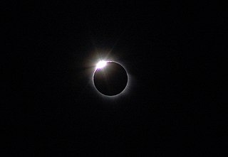
Totality from Side, Turkey
|
|
| Type of eclipse | |
| Nature | Total |
| Gamma | 0.3843 |
| Magnitude | 1.0515 |
| Maximum eclipse | |
| Duration | 247 sec (4 m 7 s) |
| Coordinates | 23°12′N 16°42′E / 23.2°N 16.7°E |
| Max. width of band | 184 km (114 mi) |
| Times (UTC) | |
| (P1) Partial begin | 7:36:50 |
| (U1) Total begin | 8:34:20 |
| Greatest eclipse | 10:12:23 |
| (U4) Total end | 11:47:55 |
| (P4) Partial end | 12:45:35 |
| References | |
| Saros | 139 (29 of 71) |
| Catalog # (SE5000) | 9521 |
A total solar eclipse occurred on March 28-29, 2006. A solar eclipse occurs when the Moon passes between Earth and the Sun, thereby totally or partly obscuring the image of the Sun for a viewer on Earth. A total solar eclipse occurs when the Moon's apparent diameter is larger than the Sun's, blocking all direct sunlight, turning day into darkness. Totality occurs in a narrow path across Earth's surface, with the partial solar eclipse visible over a surrounding region thousands of kilometres wide. It was visible from a narrow corridor which traversed half the Earth. The magnitude, that is, the ratio between the apparent sizes of the Moon and that of the Sun, was 1.052, and it was part of Saros 139.
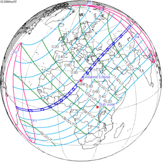
The path of totality of the Moon's shadow began at sunrise in Brazil and extended across the Atlantic to Africa, traveling across Ghana, Togo, Benin, Nigeria, Niger, Chad, Libya, and a small corner of northwest Egypt, from there across the Mediterranean Sea to Greece (Kastellórizo) and Turkey, then across the Black Sea via Georgia, Russia, and Kazakhstan to Western Mongolia, where it ended at sunset. A partial eclipse was seen from the much broader path of the Moon's penumbra, including the northern two-thirds of Africa, the whole of Europe, and Central Asia.
...
Wikipedia

