Kepulauan Bangka Belitung
|
Bangka-Belitung Islands Province Provinsi Kepulauan Bangka Belitung |
|||||||||
|---|---|---|---|---|---|---|---|---|---|
| Province | |||||||||
| Other transcription(s) | |||||||||
| • Jawi | بڠک بليتوڠ | ||||||||
| • Chinese | 邦加-勿里洞 | ||||||||
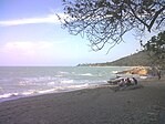
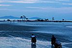
Clockwise, from top left : Parai Beach, Fuk Tet Che temple, Lengkuas Island, Matras Beach, Pasir Padi Beach, Tanjung Tinggi Beach, Tanjung Pesona Beach
|
|||||||||
|
|||||||||
| Motto: Bumi Serumpun Sebalai (Malay) (The same root, the same place) |
|||||||||
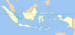
 Location of Bangka-Belitung in Indonesia |
|||||||||
| Coordinates: 2°8′S 106°7′E / 2.133°S 106.117°ECoordinates: 2°8′S 106°7′E / 2.133°S 106.117°E | |||||||||
| Country |
|
||||||||
| Established | 21 November 2000 | ||||||||
| Capital |
|
||||||||
| Government | |||||||||
| • Body | Bangka-Belitung Regional Government | ||||||||
| • Governor | Rustam Effendi (PDI-P) | ||||||||
| • Vice Governor | Hidayat Arsani | ||||||||
| Area | |||||||||
| • Total | 16,424.14 km2 (6,341.40 sq mi) | ||||||||
| Area rank | 27th | ||||||||
| Highest elevation | 669 m (2,195 ft) | ||||||||
| Population (2015) | |||||||||
| • Total | 1,372,813 | ||||||||
| • Rank | 29th | ||||||||
| • Density | 84/km2 (220/sq mi) | ||||||||
| Demonym(s) | Bangka-Belitungese Warga Bangka-Belitung (id) |
||||||||
| Demographics | |||||||||
| • Ethnic groups | Malays (52.5%), Chinese (29.1%), others. | ||||||||
| • Religion | Muslim (60%), Buddhist (22.2%), Confucianism (8.3%), Protestantism (4.8%), Roman Catholicism (1.2%), Hindu (0.1%) | ||||||||
| • Languages | Indonesian, Bangka Malay, Hakka | ||||||||
| Time zone | Indonesia Western Time (UTC+7) | ||||||||
| Postcodes | 30xxx, 31xxx, 32xxx | ||||||||
| Area codes | (62)7xx | ||||||||
| Vehicle sign | BN | ||||||||
| HDI |
|
||||||||
| HDI rank | 15th (2014) | ||||||||
| Largest city by area | Pangkal Pinang - 118.80 square kilometres (45.87 sq mi) | ||||||||
| Largest city by population | Pangkal Pinang - (174,838 - 2010) | ||||||||
| Largest regency by area | South Bangka Regency - 3,607.08 square kilometres (1,392.70 sq mi) | ||||||||
| Largest regency by population | Bangka Regency - (2,029,308 - 2010) | ||||||||
| Website | Government official site | ||||||||
| Bangka-Belitung Islands | |||||||||||||||||||
| Chinese | 邦加-勿里洞 | ||||||||||||||||||
|---|---|---|---|---|---|---|---|---|---|---|---|---|---|---|---|---|---|---|---|
|
|||||||||||||||||||
| Transcriptions | |
|---|---|
| Standard Mandarin | |
| Hanyu Pinyin | Bāng jiā-wù lǐ dòng |
| Hakka | |
| Romanization | Pâng kâ -Vút lî thung |
| Yue: Cantonese | |
| Yale Romanization | Bòng gàa-Màht léih dùhng |
| Southern Min | |
| Hokkien POJ | Pang ka-Bu̍t lí tōng |
The Bangka-Belitung Islands (Indonesian: Kepulauan Bangka Belitung), is a province of Indonesia, previously a part of South Sumatra Province. Lying off Sumatra, the province comprises two main islands, Bangka and Belitung, and several smaller ones. In 2010 its population was 1,223,048. The capital is Pangkal Pinang.
The Bangka Strait separates Sumatra and Bangka, and the Gaspar Strait separates Bangka and Belitung. The South China Sea is to the north, the Java Sea is to the south, and the province is separated from Borneo in the east by the Karimata Strait.
The province of Bangka Belitung Islands consist of two large islands of Bangka and Belitung islands and islets. Before the Tuntang capitulation Bangka and Belitung is conquered areas of the kingdom of Srivijaya, Majapahit and Mataram. After that, Bangka-Belitung became a British colony and then implemented the handover to the Dutch government held in Muntok on 10 December 1816. In the Dutch colonial period, there was resistance unceasingly conducted by Depati Barin was continued by his son named Depati Amir and ended with the exile to Kupang, East Nusa Tenggara by the Dutch Government. During the colonial era a lot of wealth in the island was taken by the invaders.
Most of the first Chinese workers who came to Indonesia were men (mainly Hakka people). They began assimilating with local people and intermarriages followed, residents coexisting peacefully in spite of differences in religion and ethnicity. When anti-Chinese riots occurred in some parts of Indonesia at the end of the Soeharto regime in 1998, local people and those of Chinese descent lived peacefully in the Bangka Belitung province.
...
Wikipedia


