2005–06 South-West Indian Ocean cyclone season
| 2005–06 South-West Indian Ocean cyclone season |

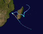
Season summary map
|
| Seasonal boundaries |
| First system formed |
September 5, 2005 |
| Last system dissipated |
April 17, 2006 |
| Strongest storm |
|
| Name |
Carina |
| • Maximum winds |
205 km/h (125 mph)
(10-minute sustained) |
| • Lowest pressure |
915 hPa (mbar) |
| Seasonal statistics |
| Total depressions |
13 |
| Total storms |
6 |
| Tropical cyclones |
3 |
| Intense tropical cyclones |
2 |
| Total fatalities |
At least 42 |
| Total damage |
Unknown |
| Related articles |
|
|
South-West Indian Ocean tropical cyclone seasons
2003–04, 2004–05, 2005–06, 2006–07, 2007–08
|
| Intense tropical cyclone (MFR) |
| Category 3 tropical cyclone (SSHWS) |
|
|
| Duration |
November 24 (entered basin) – December 3 |
| Peak intensity |
175 km/h (110 mph) (10-min) 930 hPa (mbar) |
| Tropical disturbance (MFR) |
|
|
| Duration |
January 3 – January 7 |
| Peak intensity |
45 km/h (30 mph) (10-min) 1002 hPa (mbar) |
| Tropical cyclone (MFR) |
| Category 3 tropical cyclone (SSHWS) |
|
|
| Duration |
January 20 – February 5 |
| Peak intensity |
155 km/h (100 mph) (10-min) 950 hPa (mbar) |
| Severe tropical storm (MFR) |
| Tropical storm (SSHWS) |
|
|
| Duration |
February 18 – February 23 |
| Peak intensity |
95 km/h (60 mph) (10-min) 992 hPa (mbar) |
| Intense tropical cyclone (MFR) |
| Category 4 tropical cyclone (SSHWS) |
|
|
| Duration |
February 22 – March 11 |
| Peak intensity |
205 km/h (125 mph) (10-min) 915 hPa (mbar) |
| Severe tropical storm (MFR) |
| Tropical storm (SSHWS) |
|
|
| Duration |
March 2 – March 8 |
| Peak intensity |
110 km/h (70 mph) (10-min) 980 hPa (mbar) |
| Moderate tropical storm (MFR) |
| Tropical storm (SSHWS) |
|
|
| Duration |
April 6 (left basin from April 7–13) – April 17 |
| Peak intensity |
75 km/h (45 mph) (10-min) 990 hPa (mbar) |
The 2005–06 South-West Indian Ocean cyclone season was the fifth least-active on record. The Météo-France office on the island of Réunion tracked 13 tropical disturbances, of which six intensified into a moderate tropical storm. Three of these systems proceeded to attain tropical cyclone status – reaching 10 minute maximum sustained winds of at least 120 km/h (75 mph). The American-based Joint Typhoon Warning Center also tracked eight storms in the basin. Activity was below normal due to a powerful Walker circulation, which increased convection over the neighboring Australian basin, but suppressed activity in the western Indian Ocean. As a result, most of the storms developed near or entered from the Australian basin, crossing 90°E to enter the South-West Indian Ocean.
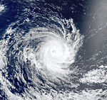
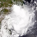
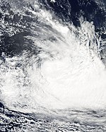
A series of four short-lived systems occurred from September to November in the northeastern portion of the basin. These were followed by the first named storm – Alvin – which was renamed after it crossed from the Australian region as Tropical Cyclone Bertie in late November. After another short-lived disturbance in late December, there was a tropical disturbance in the Mozambique Channel in January that killed 26 people when it brought heavy rainfall to Mozambique. Later in the month, Tropical Cyclone Boloetse took an erratic track across Madagascar, killing six people when it brushed the island's southwest coast. In February, there was a small, short-lived unnamed tropical storm that presented difficulties to warning agencies in determining its structure. Intense Tropical Cyclone Carina was the strongest system of the season, attaining peak 10 minute winds of 205 km/h (125 mph) in the open waters of the eastern portion of the basin. Sprawling Tropical Storm Diwa brought six months' worth of rainfall to the drought-ridden island of Réunion, reaching 2,943 mm (115.9 in) in the mountainous peaks. The rains led to flooding and landslides that killed 10 people directly or indirectly. Two of the deaths occurred when a saturated cliff collapsed onto a coastal road. The final storm, Elia, dissipated on April 17 after previously entering from the Australian basin.
...
Wikipedia


