2007–08 South-West Indian Ocean cyclone season
| 2007–08 South-West Indian Ocean cyclone season |

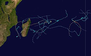
Season summary map
|
| Seasonal boundaries |
| First system formed |
October 12, 2007 |
| Last system dissipated |
March 27, 2008 |
| Strongest storm |
|
| Name |
Hondo |
| • Maximum winds |
215 km/h (130 mph)
(10-minute sustained) |
| • Lowest pressure |
915 hPa (mbar) |
| Seasonal statistics |
| Total disturbances |
15 |
| Total depressions |
13 |
| Total storms |
13 |
| Tropical cyclones |
6 |
| Total fatalities |
122 |
| Total damage |
~ $38 million (2008 USD) |
| Related articles |
|
|
South-West Indian Ocean tropical cyclone seasons
2005–06, 2006–07, 2007–08, 2008–09, 2009–10
|
| Category 1 tropical cyclone (Australian scale) |
| Tropical storm (SSHWS) |
|
|
| Duration |
July 26 – July 29 |
| Peak intensity |
75 km/h (45 mph) (10-min) 992 hPa (mbar) |
| Tropical disturbance (MFR) |
|
|
| Duration |
October 12 – October 13 |
| Peak intensity |
45 km/h (30 mph) (10-min) 1005 hPa (mbar) |
| Severe tropical storm (MFR) |
| Tropical storm (SSHWS) |
|
|
| Duration |
November 15 (Crossed 90°E) – November 28 |
| Peak intensity |
95 km/h (60 mph) (10-min) 985 hPa (mbar) |
| Severe tropical storm (MFR) |
| Category 1 tropical cyclone (SSHWS) |
|
|
| Duration |
November 17 – November 28 |
| Peak intensity |
105 km/h (65 mph) (10-min) 976 hPa (mbar) |
| Moderate tropical storm (MFR) |
| Tropical storm (SSHWS) |
|
|
| Duration |
December 11 – December 23 |
| Peak intensity |
75 km/h (45 mph) (10-min) 992 hPa (mbar) |
| Moderate tropical storm (MFR) |
| Tropical storm (SSHWS) |
|
|
| Duration |
December 17 – December 21 |
| Peak intensity |
65 km/h (40 mph) (10-min) 995 hPa (mbar) |
| Moderate tropical storm (MFR) |
| Tropical storm (SSHWS) |
|
|
| Duration |
December 29 – January 3 |
| Peak intensity |
65 km/h (40 mph) (10-min) 995 hPa (mbar) |
| Tropical disturbance (MFR) |
|
|
| Duration |
January 6 – January 8 |
| Peak intensity |
35 km/h (25 mph) (10-min) 1003 hPa (mbar) |
| Tropical cyclone (MFR) |
| Category 2 tropical cyclone (SSHWS) |
|
|
| Duration |
January 22 – February 1 |
| Peak intensity |
130 km/h (80 mph) (10-min) 972 hPa (mbar) |
The 2007–08 South-West Indian Ocean cyclone season was an event in the annual cycle of tropical cyclone formation. It began on November 15, 2007, and ended on April 30, 2008, with the exception for Mauritius and the Seychelles, which ended May 15. These dates conventionally delimit the period of each year when most tropical cyclones form in the basin, which is west of 90°E and south of the Equator. Tropical cyclones in this basin are monitored by the Regional Specialised Meteorological Centre in Réunion.
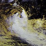
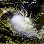
On July 26, a tropical disturbance developed within a near-equatorial trough. The next day, convection began to develop around the low while located about 1,500 kilometres (930 mi) east of Diego Garcia. Moderate wind shear temporarily caused the convection to become displaced from the center on July 27. However, later that day, the Joint Typhoon Warning Center (JTWC) assessed the chances of the low developing into a tropical cyclone as "fair". By July 29 the low was designated as Tropical Disturbance 01 while located near the edge of Météo-Frances area of responsibility. With developing banding features, increasing convection and very warm sea-surface temperatures (exceeding 28 °C; 82.4 °F), the JTWC issued a Tropical Cyclone Formation Alert for the low as they assessed the chances of development of a tropical cyclone within 48 hours as "good".
In the post-storm report issued by the Australian Bureau of Meteorology, the system was estimated to have become a Category 1 cyclone, with winds peaking at 75 km/h (45 mph), shortly before leaving Météo-Frances area of responsibility early on July 29. After leaving Météo-Frances area of responsibility, the JTWC designated the storm as Tropical Cyclone 01S. In Météo-Frances post-storm analysis, the disturbance was declassified as a tropical cyclone and the numbering, 01, was removed for unknown reasons.
...
Wikipedia


