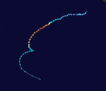
2009–10 South-West Indian Ocean cyclone season
| 2009–10 South-West Indian Ocean cyclone season |

Season summary map
|
| Seasonal boundaries |
| First system formed |
August 18, 2009 |
| Last system dissipated |
May 29, 2010 |
| Strongest storm |
|
| Name |
Edzani |
| • Maximum winds |
220 km/h (140 mph)
(10-minute sustained) |
| • Lowest pressure |
910 hPa (mbar) |
| Seasonal statistics |
| Total disturbances |
16 |
| Total depressions |
12 |
| Total storms |
10 |
| Tropical cyclones |
5 |
| Intense tropical cyclones |
2 |
| Total fatalities |
40 |
| Total damage |
Unknown |
| Related articles |
|
|
South-West Indian Ocean tropical cyclone seasons
2007–08, 2008–09, 2009–10, 2010–11, 2011-12
|
| Tropical disturbance (MFR) |
|
|
| Duration |
August 18 – August 20 |
| Peak intensity |
35 km/h (25 mph) (10-min) 1004 hPa (mbar) |
| Zone of Disturbed Weather (MFR) |
|
|
| Duration |
September 18 – September 20 |
| Peak intensity |
35 km/h (25 mph) (10-min) 1008 hPa (mbar) |
| Tropical disturbance (MFR) |
|
|
| Duration |
November 7 – November 10 |
| Peak intensity |
45 km/h (30 mph) (10-min) 1002 hPa (mbar) |
| Tropical cyclone (MFR) |
| Category 3 tropical cyclone (SSHWS) |
|
|
| Duration |
November 13 – November 18 |
| Peak intensity |
155 km/h (100 mph) (10-min) 950 hPa (mbar) |
| Moderate tropical storm (MFR) |
| Tropical storm (SSHWS) |
|
|
| Duration |
November 22 – November 25 |
| Peak intensity |
75 km/h (45 mph) (10-min) 996 hPa (mbar) |
| Intense tropical cyclone (MFR) |
| Category 4 tropical cyclone (SSHWS) |
|
|
| Duration |
December 6 – December 14 |
| Peak intensity |
195 km/h (120 mph) (10-min) 930 hPa (mbar) |
| Moderate tropical storm (MFR) |
| Tropical storm (SSHWS) |
|
|
| Duration |
December 12 – December 25 |
| Peak intensity |
85 km/h (50 mph) (10-min) 987 hPa (mbar) |
| Very intense tropical cyclone (MFR) |
| Category 5 tropical cyclone (SSHWS) |
|
|
| Duration |
January 4 (Entered basin) – January 14 |
| Peak intensity |
220 km/h (140 mph) (10-min) 910 hPa (mbar) |
| Tropical disturbance (MFR) |
|
|
| Duration |
January 15 – January 16 |
| Peak intensity |
45 km/h (30 mph) (10-min) 1005 hPa (mbar) |
The 2009–10 South-West Indian Ocean tropical cyclone year officially started on July 1, 2009, and ended on June 30, 2010, after incorporating the tropical cyclone season which ran from November 1 to April 30 for all areas except for Mauritius and the Seychelles, for which it ended on May 15, 2010. In this basin which officially runs from 30 to 90E and is to the south of the equator, the main warning center is the Regional Specialized Meteorological Center on La Reunion Island; however they delegate the naming of Cyclones to the Meteorological services of Mauritius and Madagascar.
It was predicted by the Mauritius Meteorological service that there would be between nine and eleven named storms in the South West Indian Ocean during the season. Their further assessment that there was a good probability of a named storm forming in November was justified when Tropical Cyclone Anja formed on November 14.
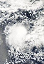
Early on August 17, the JTWC reported that an area of disturbed weather had formed about 1200 kilometres, (750 miles), to the east of Diego Garcia. The convection had a developed low level circulation center, however convection had not started to consolidate around it and was in an area of strong vertical wind shear. During that day the disturbance gradually developed further as the environment around it gradually improved and was designated as Tropical Disturbance 01 by RSMC La Reunion early the next day. However, later that day they downgraded it to a zone of disturbed weather and released their final advisory on the disturbance as it had remained weak with the low level circulation center remaining weak and exposed. Over the next few days it weakened further before dissipating on August 20.
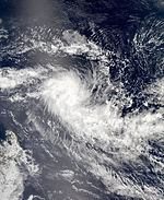
During September 17, both TCWC Jakarta and the JTWC reported that an area of convection had persisted about 740 km (460 mi), to the south east of Sumatra in Indonesia. Satellite imagery was showing that the convection was slowly starting to consolidate with a well defined low level circulation centre off the western coast of Sumatra. However it was not expected to develop any further due to being in area of high vertical wind shear in excess of 40 knots (74 km/h). Despite this it was designated as a tropical low early the next day by TCWC Perth. The JTWC then declared early the next day that the disturbance had dissipated as it crossed 90E and moved into RSMC La Reunion's area of responsibility. TCWC Perth continued to monitor the tropical low as it slowly developed further until early on September 20 when RSMC La Reunion designated it as the second Zone of Disturbed Weather of the 2009–10 as convection had developed over the system and the amount of vertical wind shear over the system had dropped. However they released their final advisory later that day as convection had dissipated in the northern quadrants of the system.
...
Wikipedia


