2009–10 South Pacific cyclone season
| 2009–10 South Pacific cyclone season |

Season summary map
|
| Seasonal boundaries |
| First system formed |
December 3, 2009 |
| Last system dissipated |
April 5, 2010 |
| Strongest storm |
|
| Name |
Ului |
| • Maximum winds |
215 km/h (130 mph)
(10-minute sustained) |
| • Lowest pressure |
915 hPa (mbar) |
| Seasonal statistics |
| Total disturbances |
15 |
| Total depressions |
13 |
| Tropical cyclones |
8 |
| Severe tropical cyclones |
5 |
| Total fatalities |
12 total |
| Total damage |
$163 million (2010 USD) |
| Related articles |
|
|
South Pacific tropical cyclone seasons
2007–08, 2008–09, 2009–10, 2010–11, 2011–12
|
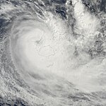
| Category 2 tropical cyclone (Australian scale) |
| Category 1 tropical cyclone (SSHWS) |
|
|
| Duration |
December 3 – December 15 |
| Peak intensity |
110 km/h (70 mph) (10-min) 975 hPa (mbar) |
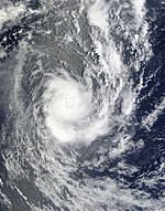
| Tropical depression (Australian scale) |
|
|
| Duration |
January 7 – January 10 |
| Peak intensity |
65 km/h (40 mph) (10-min) 1002 hPa (mbar) |
| Tropical depression (Australian scale) |
|
|
| Duration |
January 18 – January 20(crossed 160°E)
|
| Peak intensity |
Winds not specified 1002 hPa (mbar) |
| Tropical depression (Australian scale) |
|
|
| Duration |
January 23 – January 28 |
| Peak intensity |
Winds not specified 998 hPa (mbar) |
| Category 1 tropical cyclone (Australian scale) |
| Tropical storm (SSHWS) |
|
|
| Duration |
January 27 – January 31 |
| Peak intensity |
75 km/h (45 mph) (10-min) 990 hPa (mbar) |
| Category 4 severe tropical cyclone (Australian scale) |
| Category 4 tropical cyclone (SSHWS) |
|
|
| Duration |
January 29 – February 8 |
| Peak intensity |
185 km/h (115 mph) (10-min) 925 hPa (mbar) |
| Tropical depression (Australian scale) |
|
|
| Duration |
February 1 – February 4 |
| Peak intensity |
55 km/h (35 mph) (10-min) 997 hPa (mbar) |
| Category 3 severe tropical cyclone (Australian scale) |
| Category 2 tropical cyclone (SSHWS) |
|
|
| Duration |
February 6 – February 11 |
| Peak intensity |
140 km/h (85 mph) (10-min) 960 hPa (mbar) |
| Category 3 severe tropical cyclone (Australian scale) |
| Category 3 tropical cyclone (SSHWS) |
|
|
| Duration |
February 9 – February 17 |
| Peak intensity |
155 km/h (100 mph) (10-min) 945 hPa (mbar) |
The 2009–10 South Pacific cyclone season began on December 3, 2009 with the formation of Tropical Disturbance 01F, 32 days after the cyclone season had officially begun on November 1, 2009. The season ended on April 30, 2010. These dates conventionally delimit the period of each year when most tropical cyclones form in the southern Pacific Ocean east of 160°E. Additionally, the regional tropical cyclone operational plan defines a tropical cyclone year separately from a tropical cyclone season; the "tropical cyclone year" began on July 1, 2009 and ended on June 30, 2010. Tropical cyclones between 160°E and 120°W and north of 25°S are monitored by the Fiji Meteorological Service. Those that move south of 25°S are monitored by the Tropical Cyclone Warning Centre in Wellington, New Zealand. The first tropical disturbance of the season formed on December 3, about 1015 km (700 mi) to the north of Suva, Fiji and later intensified into Tropical Cyclone Mick. The last system, 15F, dissipated on April 5 of the following year.
Ahead of the cyclone season, RSMC Nadi, TCWC Wellington, the Australian Bureau of Meteorology (BoM), the New Zealand National Institute of Water and Atmospheric Research (NIWA) and various other Pacific Meteorological services, all contributed towards the Island Climate Update tropical cyclone outlook that was released during October 2009. The outlook took into account the El Nino conditions and normal developments during a near-normal season. The outlook called for a near average number of tropical cyclones for the 2009–10 season, with eight to eleven tropical cyclones, to occur between 135°E and 120°W compared to an average of about nine. At least two of the tropical cyclones were expected to become category 3 severe tropical cyclones, while one was likely to become a category 4 severe tropical cyclone. The outlook also noted that it was likely that the first storm would develop prior to the end of December. During February 2010, a seasonal forecast update was issued which maintained the original forecast of eight to eleven named tropical cyclones. In addition to contributing towards the Island Climate Update outlooks, RSMC Nadi issued their own seasonal forecast for their area of responsibility. Within their outlook RSMC Nadi predicted that between eight and eleven tropical cyclones, would occur within the basin compared to an average of around 9. At least two of the tropical cyclones were expected to become category 3 severe tropical cyclones, while one was likely to become a category 4 severe tropical cyclone.
...
Wikipedia


