2003–04 South-West Indian Ocean cyclone season
| 2003–04 South-West Indian Ocean cyclone season | |
|---|---|

Season summary map
|
|
| Seasonal boundaries | |
| First system formed | September 28, 2003 |
| Last system dissipated | May 24, 2004 |
| Strongest storm | |
| Name | Gafilo |
| • Maximum winds | 230 km/h (145 mph) (10-minute sustained) |
| • Lowest pressure | 895 hPa (mbar) |
| Seasonal statistics | |
| Total disturbances | 16 |
| Total storms | 10 |
| Tropical cyclones | 5 |
| Intense tropical cyclones | 3 |
| Total fatalities | 396 |
| Total damage | $250 million (2004 USD) |
| Related articles | |
| Severe tropical storm (MFR) | |
| Tropical storm (SSHWS) | |
| Duration | September 28 – October 4 |
|---|---|
| Peak intensity | 95 km/h (60 mph) (10-min) 995 hPa (mbar) |
| Intense tropical cyclone (MFR) | |
| Category 3 tropical cyclone (SSHWS) | |
| Duration | November 9 – November 25 |
|---|---|
| Peak intensity | 175 km/h (110 mph) (10-min) 935 hPa (mbar) |
| Tropical cyclone (MFR) | |
| Category 1 tropical cyclone (SSHWS) | |
| Duration | December 4 – December 20 |
|---|---|
| Peak intensity | 120 km/h (75 mph) (10-min) 975 hPa (mbar) |
| Severe tropical storm (MFR) | |
| Tropical storm (SSHWS) | |
| Duration | December 27 – January 4 |
|---|---|
| Peak intensity | 100 km/h (65 mph) (10-min) 980 hPa (mbar) |
| Tropical cyclone (MFR) | |
| Category 1 tropical cyclone (SSHWS) | |
| Duration | January 24 – February 4 |
|---|---|
| Peak intensity | 120 km/h (75 mph) (10-min) 970 hPa (mbar) |
| Intense tropical cyclone (MFR) | |
| Category 4 tropical cyclone (SSHWS) | |
| Duration | January 26 – February 6 |
|---|---|
| Peak intensity | 185 km/h (115 mph) (10-min) 930 hPa (mbar) |
| Very intense tropical cyclone (MFR) | |
| Category 5 tropical cyclone (SSHWS) | |
| Duration | March 1 – March 15 |
|---|---|
| Peak intensity | 230 km/h (145 mph) (10-min) 895 hPa (mbar) |
| Severe tropical storm (MFR) | |
| Category 1 tropical cyclone (SSHWS) | |
| Duration | March 10 (Crossed 90°E) – March 16 |
|---|---|
| Peak intensity | 110 km/h (70 mph) (10-min) 975 hPa (mbar) |
| Tropical disturbance (MFR) | |
| Tropical depression (SSHWS) | |
| Duration | March 15 – March 28 |
|---|---|
| Peak intensity | 45 km/h (30 mph) (10-min) 1002 hPa (mbar) |
The 2003–04 South-West Indian Ocean cyclone season was an annual event of tropical cyclone formation. It started on November 15, 2003 and ended on April 30, 2004. For Mauritius and the Seychelles, the season continued until May 15. These dates conventionally delimit the period of each year when most tropical cyclones form in the basin, which is west of 90°E and south of the Equator. Tropical cyclones in this basin are monitored by the Regional Specialised Meteorological Centre in Réunion.
This early out-of-season storm formed on September 29 and dissipated on October 4. It formed at a very low latitude but threatened no land. The name was contributed by Tanzania.
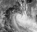
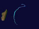
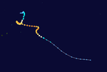
It first formed on November 9 and intensified to an intense cyclone, winds reaching 100 kn. It weakened below tropical disturbance status on November 15. It intensified again on November 18 and reached a secondary peak of 70 kn, before dissipating on November 22.
Formed on December 5 and became extratropical on December 21. It crossed Madagascar, but caused little if any damage. Throughout Madagascar at least 150 mm (5.9 in) of rain fell, with northern areas receiving totals in excess of 300 mm (12 in). Parts of Mozambique also recorded heavy rainfall in relation to Cela, with between 75 and 150 mm (3.0 and 5.9 in) falling in northern regions of the country.
Formed on December 29, 2003, and moved poleward while remaining east of La Reunion. The system was absorbed by a larger extratropical system on January 4, 2004. It passed close to Mauritius.
Existed between January 22 and January 24.
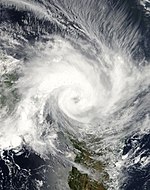
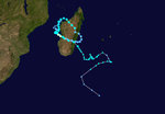
Elita developed on January 24 in the Mozambique Channel. It strengthened to become a strong tropical storm before striking northwestern Madagascar on January 28. Elita weakened to tropical depression status while crossing the island, and after turning to the west it restrengthened to a tropical storm before moving ashore on January 31. The cyclone intensified again after reaching waters, and Elita turned to the southeast to make its final landfall on February 3 near peak intensity. By February 5 it underwent extratropical transition, and the remnants of Elita drifted erratically before weakening further on February 12.
...
Wikipedia


