2003–04 Australian region cyclone season
| 2003–04 Australian region cyclone season | |
|---|---|
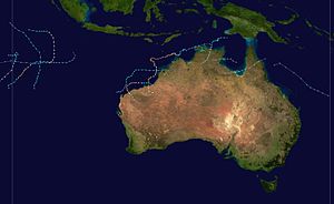
Season summary map
|
|
| Seasonal boundaries | |
| First system formed | 6 December 2003 |
| Last system dissipated | 27 March 2004 |
| Strongest storm | |
| Name | Fay |
| • Maximum winds | 215 km/h (130 mph) (10-minute sustained) |
| • Lowest pressure | 910 hPa (mbar) |
| Seasonal statistics | |
| Tropical lows | 13 |
| Tropical cyclones | 10 |
| Severe tropical cyclones | 5 |
| Total fatalities | Unknown |
| Total damage | Unknown |
| Related articles | |
| Category 3 severe tropical cyclone (Australian scale) | |
| Category 1 tropical cyclone (SSHWS) | |
| Duration | 6 December – 12 December |
|---|---|
| Peak intensity | 160 km/h (100 mph) (10-min) 950 hPa (mbar) |
| Category 3 severe tropical cyclone (Australian scale) | |
| Category 1 tropical cyclone (SSHWS) | |
| Duration | 16 December – 23 December |
|---|---|
| Peak intensity | 120 km/h (75 mph) (10-min) 970 hPa (mbar) |
| Tropical low (Australian scale) | |
| Tropical storm (SSHWS) | |
| Duration | 1 January – 6 January |
|---|---|
| Peak intensity | 75 km/h (45 mph) (10-min) 992 hPa (mbar) |
| Category 2 tropical cyclone (Australian scale) | |
| Tropical storm (SSHWS) | |
| Duration | 28 January – 1 February |
|---|---|
| Peak intensity | 95 km/h (60 mph) (10-min) 985 hPa (mbar) |
| Category 2 tropical cyclone (Australian scale) | |
| Tropical storm (SSHWS) | |
| Duration | 10 February – 15 February |
|---|---|
| Peak intensity | 90 km/h (55 mph) (10-min) 985 hPa (mbar) |
| Category 4 severe tropical cyclone (Australian scale) | |
| Category 3 tropical cyclone (SSHWS) | |
| Duration | 25 February – 3 March |
|---|---|
| Peak intensity | 185 km/h (115 mph) (10-min) 935 hPa (mbar) |
| Category 1 tropical cyclone (Australian scale) | |
| Tropical depression (SSHWS) | |
| Duration | 27 February – 4 March |
|---|---|
| Peak intensity | 65 km/h (40 mph) (10-min) 991 hPa (mbar) |
| Category 2 tropical cyclone (Australian scale) | |
| Category 1 tropical cyclone (SSHWS) | |
| Duration | 8 March – 10 March |
|---|---|
| Peak intensity | 95 km/h (60 mph) (10-min) 985 hPa (mbar) |
| Category 5 severe tropical cyclone (Australian scale) | |
| Category 4 tropical cyclone (SSHWS) | |
| Duration | 12 March – 28 March |
|---|---|
| Peak intensity | 215 km/h (130 mph) (10-min) 910 hPa (mbar) |
The 2003–04 Australian region cyclone season was an event in the ongoing cycle of tropical cyclone formation. It began on 1 November 2003 and ended on 30 April 2004. The regional tropical cyclone operational plan also defines a tropical cyclone year separately from a tropical cyclone season, which runs from 1 July 2003 to 30 June 2004.
Tropical cyclones in this area are monitored by four Tropical Cyclone Warning Centres (TCWCs): the Australian Bureau of Meteorology in Perth, Darwin, and Brisbane; and TCWC Port Moresby in Papua New Guinea.
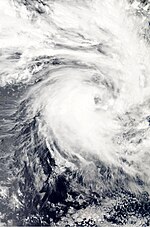
Formed on 6 December and dissipated on 12 December.
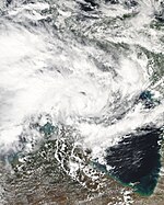
Formed on 16 December and dissipated on 23 December. Crossed the Northern Territory coast as a Category 3.
Formed on 1 January 2004 and dissipated on 6 January. Operationally monitored Ken to have reached tropical cyclone intensity for 24 hours, but post-analysis revealed that Ken never was a tropical cyclone.
Existed between 10 and 17 January. Caused heavy rainfall across western Queensland and New South Wales.
Formed on 28 January and dissipated on 1 February.
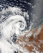
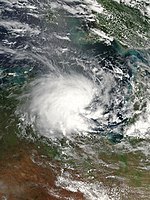
A tropical low developed on 10 February in the northern Coral Sea, within an active monsoon trough. The system developed rapidly and becoming Tropical Cyclone Fritz when it was northeast of Cooktown. Fritz moved rapidly to the west, and made landfall on the northern Queensland coast with winds of 75 km/h. The storm lost its tropical character as it crossed the Cape York Peninsula and entered the Gulf of Carpentaria on 11 February. The low reintensified over the favourable conditions in the Gulf, and reached its peak with 95 km/h winds near Mornington Island. Radar imagery showed evidence of an eye as the storm passed over the island on 12 February. It then crossed over the coast onto mainland Australian and degenerated overland. The remnant travelled over Northern Territory and Western Australia, before merging with a cold front to the south of Perth.
...
Wikipedia

