2001–02 South-West Indian Ocean cyclone season
| 2001–02 South-West Indian Ocean cyclone season |

Season summary map
|
| Seasonal boundaries |
| First system formed |
October 3, 2001 |
| Last system dissipated |
June 15, 2002 |
| Strongest storm |
|
| Name |
Hary |
| • Maximum winds |
220 km/h (140 mph)
(10-minute sustained) |
| • Lowest pressure |
905 hPa (mbar) |
| Seasonal statistics |
| Total disturbances |
15 |
| Total depressions |
13 |
| Total storms |
11 |
| Tropical cyclones |
9 (record high)
|
| Intense tropical cyclones |
5 |
| Very intense tropical cyclones |
1 |
| Total fatalities |
52 total |
| Total damage |
$287 million (2002 USD) |
| Related articles |
|
|
South-West Indian Ocean tropical cyclone seasons
1999–00, 2000–01, 2001–02, 2002–03, 2003–04
|
| Severe tropical storm (MFR) |
| Tropical storm (SSHWS) |
|
|
| Duration |
October 28 (Crossed 90°E) – November 8 |
| Peak intensity |
95 km/h (60 mph) (10-min) 985 hPa (mbar) |
| Tropical cyclone (MFR) |
| Category 1 tropical cyclone (SSHWS) |
|
|
| Duration |
November 30 (Crossed 90°E) – December 5 |
| Peak intensity |
120 km/h (75 mph) (10-min) 968 hPa (mbar) |
| Severe tropical storm (MFR) |
| Tropical storm (SSHWS) |
|
|
| Duration |
December 30 – January 3 |
| Peak intensity |
100 km/h (65 mph) (10-min) 980 hPa (mbar) |
| Intense tropical cyclone (MFR) |
| Category 4 tropical cyclone (SSHWS) |
|
|
| Duration |
January 16 – January 25 |
| Peak intensity |
215 km/h (130 mph) (10-min) 910 hPa (mbar) |
| Tropical cyclone (MFR) |
| Category 1 tropical cyclone (SSHWS) |
|
|
| Duration |
January 22 – January 30 |
| Peak intensity |
130 km/h (80 mph) (10-min) 965 hPa (mbar) |
| Intense tropical cyclone (MFR) |
| Category 4 tropical cyclone (SSHWS) |
|
|
| Duration |
January 30 – February 11 |
| Peak intensity |
195 km/h (120 mph) (10-min) 925 hPa (mbar) |
| Intense tropical cyclone (MFR) |
| Category 4 tropical cyclone (SSHWS) |
|
|
| Duration |
February 14 – February 23 |
| Peak intensity |
205 km/h (125 mph) (10-min) 920 hPa (mbar) |
| Very intense tropical cyclone (MFR) |
| Category 5 tropical cyclone (SSHWS) |
|
|
| Duration |
March 3 – March 13 |
| Peak intensity |
220 km/h (140 mph) (10-min) 905 hPa (mbar) |
| Intense tropical cyclone (MFR) |
| Category 3 tropical cyclone (SSHWS) |
|
|
| Duration |
March 21 – March 29 |
| Peak intensity |
165 km/h (105 mph) (10-min) 945 hPa (mbar) |
The 2001–02 South-West Indian Ocean cyclone season had the earliest named storm since 1992. Many storms formed in the north-east portion of the basin, and several more originated around Australia. The basin is defined as the waters of the Indian Ocean west of longitude 90°E to the coast of Africa and south of the equator. Eleven tropical storms formed, compared to an average of nine. Tropical systems were present during 73 days, which was significantly higher than the average of 58.
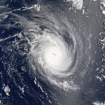
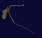
Tropical cyclones in this basin are monitored by the Regional Specialized Meteorological Center (RSMC) in Réunion. The season started on November 1, 2001, and ended on April 30, 2002; for Mauritius and the Seychelles, the season continued until May 15. These dates conventionally delimit the period of each year when most tropical cyclones form in the basin; however, storms formed both before and after the designated season. The first storm was Andre, which emerged from the Australian basin as Tropical Cyclone Alex in late October. The strongest storm, Cyclone Hary, was the first very intense tropical cyclone since 2000; it hit Madagascar, where it caused lighter damage than expected but three deaths. In January, Cyclone Dina left heavy damage in the Mascarene Islands, particularly on Réunion, where it dropped 2,102 mm (82.8 in) of rainfall. The final storm was Cyclone Kesiny, which killed 33 people when it struck Madagascar in the midst of a political crisis.
Météo-France's meteorological office in Réunion (MFR) is the official Regional Specialized Meteorological Center for the South-West Indian Ocean, tracking all tropical cyclones from the east coast of Africa to 90° E. The Joint Typhoon Warning Center (JTWC), which is a joint United States Navy – United States Air Force task force that issues tropical cyclone warnings for the region, also issued advisories for storms during the season. Following the season, the start of the tropical cyclone year was changed to July 1, which defines the boundary between tropical cyclone seasons.
...
Wikipedia


