Shoreham, Vermont
| Shoreham, Vermont | |
|---|---|
| Town | |

Shoreham Congregational Church
|
|
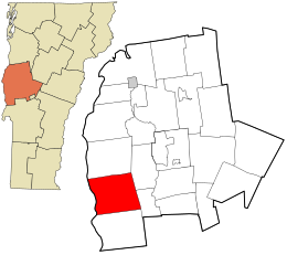
 Location in Addison County and the state of Vermont. |
|
| Coordinates: 43°53′31″N 73°18′45″W / 43.89194°N 73.31250°WCoordinates: 43°53′31″N 73°18′45″W / 43.89194°N 73.31250°W | |
| Country | United States |
| State | Vermont |
| County | Addison |
| Area | |
| • Total | 46.4 sq mi (120.1 km2) |
| • Land | 43.4 sq mi (112.5 km2) |
| • Water | 2.9 sq mi (7.6 km2) |
| Elevation | 344 ft (105 m) |
| Population (2010) | |
| • Total | 1,265 |
| • Density | 29/sq mi (11.2/km2) |
| Time zone | Eastern (EST) (UTC-5) |
| • Summer (DST) | EDT (UTC-4) |
| ZIP code | 05770 |
| Area code | 802 |
| FIPS code | 50-65050 |
| GNIS feature ID | 1462209 |
| Website | www |
Shoreham /ˈʃɔːrəm/ is a town in Addison County, Vermont, United States. The population was 1,265 at the 2010 census.
Shoreham is located in western Addison County along the shore of Lake Champlain. The western boundary of the town, which follows the center of the lake, is also the state border with New York. Neighboring Vermont towns are Bridport to the north, Cornwall and Whiting to the east, and Orwell to the south. Ticonderoga, New York, is to the west across Lake Champlain, accessible in the summertime by the Ticonderoga–Larrabees Point Ferry, a diesel-powered cable ferry.
According to the United States Census Bureau, Shoreham has a total area of 46.4 square miles (120.1 km2), of which 43.4 square miles (112.5 km2) is land and 2.9 square miles (7.6 km2), or 6.36%, is water.
The village of Shoreham is located at the intersection of Vermont Route 22A and Vermont Route 74.
As of the census of 2000, there were 1,222 people, 453 households, and 342 families residing in the town. The population density was 28.1 people per square mile (10.8/km2). There were 556 housing units at an average density of 12.8 per square mile (4.9/km2). The racial makeup of the town was 98.53% White, 0.65% African American, 0.25% Native American, 0.33% Asian, and 0.25% from two or more races. Hispanic or Latino of any race were 0.49% of the population.
...
Wikipedia
