Senapelan
| Pekanbaru | |||||||||
|---|---|---|---|---|---|---|---|---|---|
| City | |||||||||
| Other transcription(s) | |||||||||
| • Jawi | ڤكنبارو | ||||||||
| • Chinese | 北干巴鲁 | ||||||||
| • Pinyin | Běigānbālǔ | ||||||||
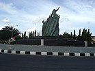
Clockwise from top: An-Nur Great Mosque Pekanbaru, SKA Mall, Riau Main Stadium, Soeman HS Library, Pekanbaru's Chinatown, Idrus Tintin Arts Hall, and Zapin Dance Statue/Pekanbaru Zero Point Roundabout
|
|||||||||
|
|||||||||
| Nickname(s): "PKU", "Pekan", "Pakan", "Pakanbaru", "Koto Pakanbaru" | |||||||||
 Location of Pekanbaru in Indonesia |
|||||||||
| Location of Pekanbaru in Indonesia | |||||||||
| Coordinates: 0°32′0″N 101°27′0″E / 0.53333°N 101.45000°ECoordinates: 0°32′0″N 101°27′0″E / 0.53333°N 101.45000°E | |||||||||
| Country |
|
||||||||
| Province |
|
||||||||
| Founded | 22 June 1784 | ||||||||
| Government | |||||||||
| • Mayor | Firdaus | ||||||||
| Area | |||||||||
| • Total | 632.26 km2 (244.12 sq mi) | ||||||||
| Elevation | 12 m (39 ft) | ||||||||
| Population (2014) | |||||||||
| • Total | 1,093,416 | ||||||||
| • Density | 1,729/km2 (4,480/sq mi) | ||||||||
| Demographics | |||||||||
| • Ethnic groups |
Minangkabau Malay Javanese Batak Chinese |
||||||||
| • Religion |
Islam 84.88% Christianity 9.60% Buddhism 3.47% Catholic 1.26% Hinduism 0.03% Confucianism 0.03% Others 0.01% |
||||||||
| Time zone | WIB (UTC+7) | ||||||||
| Postal code | 28131 | ||||||||
| Area code(s) | +62 761 | ||||||||
| Vehicle registration | BM | ||||||||
| Website | www |
||||||||
| Pekanbaru | |||||||||||||||||||
| Traditional Chinese | 北乾巴魯 | ||||||||||||||||||
|---|---|---|---|---|---|---|---|---|---|---|---|---|---|---|---|---|---|---|---|
| Simplified Chinese | 北干巴鲁 | ||||||||||||||||||
|
|||||||||||||||||||
Pekanbaru (Jawi: ڤكنبارو, Chinese: 北干巴鲁; pinyin: Běigānbālǔ, Dutch: Pakanbaroe), is the capital of Riau, on the island of Sumatra . It has an area of 632.26 km² with a population of 1,093,416.
It is located on the banks of the Siak River, which drains into the Strait of Malacca. As a result, Pekanbaru has direct access to the busy strait and was long known as a trading port (the city name is derived from the Indonesian words for 'new market', "pekan" meaning 'market' and "baru" meaning 'new'). The city is divided into 12 subdistricts (kecamatan). This city is served by the Sultan Syarif Kasim II International Airport and Sungai Duku Port that is located by the Siak River. A settlement has existed on the site since the 17th century. In the late 19th century, the city was developed to serve the coffee and coal industries, and the Dutch built roads to help ship goods to Singapore and Malacca.
When Sultan Abdul Jalil Alamuddin Syah (1766-1780) moved the capital of the Kingdom of Siak from Mempura to Senapelan (which is now Pekanbaru), this township used to be the settlement only for some people, especially the sultanate's family. However, due to the development in the trading sector and the fact that more people decided to settle in this township, the sultan wanted to make Senapelan become the center of the trading sector of the Kingdom of Siak. However, the sultan's goal was not completely achieved, thereafter he decided to move the capital once again, to Siak Sri Indrapura.
In 1749, under the terms of a peace treaty between the Sultan of Johor and the Dutch East India Company (VOC) Siak was put under Dutch administration. The Sultan moved residence to a palace in Senapelan built in 1760.
...
Wikipedia


