Jurong
| Jurong | ||||||||||
|---|---|---|---|---|---|---|---|---|---|---|
| Other transcription(s) | ||||||||||
| • Chinese | 裕 廊 | |||||||||
| • Pinyin | Yù Láng | |||||||||
| • Malay | Jurong | |||||||||
| • Tamil | ஜூரோங் | |||||||||
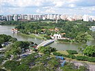
From top left to right: Flats along Jurong East, Chinese Garden and Jurong Lake, The Malaysia–Singapore Second Link as viewed from Tuas, Soon Lee Bus Park with Jurong Industrial Estate in the background, Lakeside MRT Station, Jurong Hill, Jurong Port, Jurong Bird Park
|
||||||||||
| Location of Jurong within Singapore | ||||||||||
| Coordinates: 1°20′56.24″N 103°43′9.71″E / 1.3489556°N 103.7193639°E | ||||||||||
| Country |
|
|||||||||
| Region | West Region | |||||||||
| Mainland composition |
Corresponding PAs
|
|||||||||
| Offshore islands |
3
|
|||||||||
| CDC | ||||||||||
| Town councils |
|
|||||||||
| Constituencies | ||||||||||
| Demonym(s) |
Colloquial
|
|||||||||
| Postal district | 22 | |||||||||
Colloquial
Jurong /dʒuːrɒŋ/ (Chinese: 裕 廊, Tamil: ஜூரோங்) is a geographical region located at the south-westernmost point of the West Region of Singapore. Although mostly vaguely defined, the region's extent roughly covers the planning areas of Jurong East, Jurong West, Boon Lay, and Pioneer, along with Jurong Island in the Western Islands cluster and the southernmost portions of the Western Water Catchment. Should it be described at its greatest historical extent, the region can also include present-day Bukit Batok and Tuas as well. Jurong also covers several offshore islands as well, including Pulau Damar Laut and Pulau Samulun, both of which are located within the planning areas of Jurong East and Boon Lay respectively; along with the aforementioned Jurong Island. The coastline of the region on mainland Singapore, faces the strait of Selat Jurong, while the southernmost island of the region, Jurong Island, faces the strait of Selat Pandan.
Jurong was largely industrialized in the early 1960s in a response to the general economic situation of post-war Singapore. The heavy redevelopment of the region paved the way for the opening of a large-scale industrial sector in the country, something which was unprecedented at that time.
...
Wikipedia


