Interstate 20 (Georgia)
| Interstate 20 | |||||||
|---|---|---|---|---|---|---|---|
 |
|||||||
| Route information | |||||||
| Maintained by Georgia DOT | |||||||
| Length: | 202.61 mi (326.07 km) | ||||||
| Existed: | 1963 – present | ||||||
| Major junctions | |||||||
| West end: |
|
||||||
| East end: |
|
||||||
| Location | |||||||
| Counties: | Haralson, Carroll, Douglas, Cobb, Fulton, DeKalb, Rockdale, Newton, Walton, Morgan, Greene, Taliaferro, Warren, McDuffie, Columbia, Richmond | ||||||
| Highway system | |||||||
|
|||||||
| Interstate 520 | |
|---|---|
| Location: | Augusta, Georgia–North Augusta, South Carolina |
| Length: | 23.34 mi (37.56 km) |
| Existed: | 1980–present |
| Interstate 420 | |
|---|---|
| Location: | Atlanta |
| Length: | 5.40 mi (8.69 km) |
| Existed: | 1983–1986 |
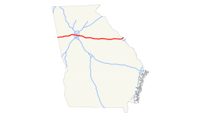
In the U.S. state of Georgia, Interstate 20 (I-20) travels from the Alabama state line to the Savannah River, which is the South Carolina state line. The highway enters the state near Tallapoosa. It travels through the Atlanta metropolitan area and exits the state in Augusta. The highway also travels through the cities of Bremen, Douglasville, Conyers, Covington, and Madison. I-20 has the unsigned state highway designation of State Route 402 (SR 402).
I-20 is four lanes wide in much of the state. In the Atlanta metropolitan area, the highway ranges from six lanes wide in the most outlying counties to 10 lanes wide in downtown Atlanta.
I-20 enters Georgia from Alabama south-southwest of Tallapoosa. The state line is the Central–Eastern time zone boundary. It travels to the east-northeast and crosses over Williams Creek. It passes the Georgia Visitor Information Center. The highway crosses over Walton Creek just before briefly entering the city limits of Tallapoosa. Immediately after it leaves the city limits, it has an interchange with SR 100. Within the interchange, I-20 enters the city limits of Tallapoosa twice more. After crossing over Blalock Creek, it curves to the east. After it curves back to the east-northeast, it crosses over Walker Creek twice. It curves to the east-southeast and travels along the southern edge of Waco, where it has an interchange with Waco Road. The interstate then enters Bremen. Almost immediately, it then enters Carroll County.
...
Wikipedia

