Columbia County, Georgia
| Columbia County, Georgia | |
|---|---|

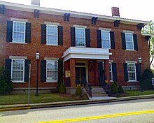
Columbia County Courthouse in Appling
|
|
 Location in the U.S. state of Georgia |
|
 Georgia's location in the U.S. |
|
| Founded | 1790 |
| Seat |
Appling (de jure) Evans (de facto) |
| Largest city | Grovetown |
| Area | |
| • Total | 308 sq mi (798 km2) |
| • Land | 290 sq mi (751 km2) |
| • Water | 18 sq mi (47 km2), 5.7% |
| Population (est.) | |
| • (2015) | 144,052 |
| • Density | 403.06/sq mi (157.44/km²) |
| Congressional districts | 10th, 12th |
| Time zone | Eastern: UTC-5/-4 |
| Website | www |
Columbia County is a county located in the US state of Georgia. As of 2013, the population was 135,416. The legal county seat is Appling, but the location of Columbia County's government and courts is Evans.
Columbia County is included in the Augusta-Richmond County, GA-SC Metropolitan Statistical Area, and is currently one of the fastest-growing counties in the United States. It is located along the Savannah River.
Columbia County, the 12th county formed in Georgia, was created by an act of the Legislature of Georgia on December 10, 1790 from Richmond County.
This area along the Savannah River had been inhabited for thousands of years by various cultures of indigenous peoples. The area had been home to the historic Muscogee-speaking Creek; Yuchi, people speaking a language isolate; and Iroquoian-speaking Cherokee for years prior to European colonization. The Yuchi had moved south from Tennessee because of pressure from the Cherokee, who continued to move into the Piedmont and soon dominated the Native American tribes. One of the oldest archaeological sites in the nation to contain pottery can be found on Stallings Island.
During the Colonial era, settlement of what would become Columbia County occurred primarily due to colonists settling at the second city in Georgia, Augusta, located on the fall line. When the British Province of Georgia became a crown colony in 1755 and was divided into parishes, the area around Augusta became St. Paul's Parish. The primary areas of settlement were Augusta; Wrightsboro (a Quaker settlement named for James Wright, the royal governor); and Brownsborough, which was near the present-day location of North Columbia Elementary School. Brownsborough was settled by Scots, mainly from northern Scotland and the Orkney Islands, brought over as indentured workers by Thomas "Burnfoot" Brown.
...
Wikipedia
