Haralson County, Georgia
| Haralson County, Georgia | |
|---|---|

Former Haralson County Courthouse in Buchanan
|
|
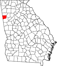
 Location in the U.S. state of Georgia |
|
 Georgia's location in the U.S. |
|
| Founded | January 26, 1856 |
| Named for | Hugh A. Haralson |
| Seat | Buchanan |
| Largest city | Bremen |
| Area | |
| • Total | 283 sq mi (733 km2) |
| • Land | 282 sq mi (730 km2) |
| • Water | 1.0 sq mi (3 km2), 0.4% |
| Population | |
| • (2010) | 28,780 |
| • Density | 102/sq mi (39/km²) |
| Congressional district | 14th |
| Time zone | Eastern: UTC-5/-4 |
Haralson County is a county located in the northwestern part of the U.S. state of Georgia. As of the 2010 census, the population was 28,780. The county seat is Buchanan. The county was created on January 26, 1856 and was named for Hugh A. Haralson, a former Georgia congressman.
Haralson County is part of the Atlanta-Sandy Springs-Roswell, GA Metropolitan Statistical Area.
The county was originally governed by a sole Commissioner of Roads and Revenues. The last occupant of this office was Charles Sanders (D). The county is now governed by a five-member Board of Commissioners, which replaced the single-commissioner form beginning with the term starting in January 2005. The Chairman of the Board is elected county-wide. The current occupant of this office is Allen Poole (R), who had previously come close to winning election in the single-commissioner era. There are four other commissioners, one elected from each of four geographical districts. The current occupants of these offices are District 1's Kenneth Smith(R), District 2's Jamie Brown Bennett (R), District 3's John Dobbs(D) and District 4's Sammy Robinson (D). The current sheriff of Haralson County is Eddie Mixon. Judge J. Edward "Eddie" Hulsey, Jr. is the current probate judge.
According to the U.S. Census Bureau, the county has a total area of 283 square miles (730 km2), of which 282 square miles (730 km2) is land and 1.0 square mile (2.6 km2) (0.4%) is water.
The vast majority of Haralson County is located in the Upper Tallapoosa River sub-basin of the ACT River Basin (Coosa-Tallapoosa River Basin). Just the very northwestern corner of the county is located in the Upper Coosa River sub-basin of the same ACT River Basin.
As of the census of 2000, there were 25,690 people, 9,826 households, and 7,192 families residing in the county. The population density was 91 people per square mile (35/km²). There were 10,719 housing units at an average density of 38 per square mile (15/km²). The racial makeup of the county was 92.97% White, 5.40% Black or African American, 0.25% Native American, 0.34% Asian, 0.20% from other races, and 0.83% from two or more races. 0.56% of the population were Hispanic or Latino of any race.
...
Wikipedia
