Ford Heights, Illinois
|
Ford Heights, Illinois East Chicago Heights, Illinois |
|
|---|---|
| Village | |
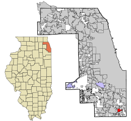
 Location in Cook County and the state of Illinois. |
|
 Location of Illinois in the United States |
|
| Coordinates: 41°30′33″N 87°35′17″W / 41.50917°N 87.58806°WCoordinates: 41°30′33″N 87°35′17″W / 41.50917°N 87.58806°W | |
| Country |
|
| State | Illinois |
| County | Cook |
| Township | Bloom |
| Incorporated | 1949 |
| Government | |
| • Mayor | Charles Griffin |
| Area | |
| • Total | 1.95 sq mi (5.1 km2) |
| • Land | 1.95 sq mi (5.1 km2) |
| • Water | 0.00 sq mi (0.0 km2) 0% |
| Population (2010) | |
| • Total | 2,763 |
| • Density | 1,416.9/sq mi (547.1/km2) |
| Down 20.05% from 2000 | |
| Standard of living (2007-11) | |
| • Per capita income | $12,217 |
| • Median home value | $80,200 |
| ZIP code(s) | 60411 |
| Area code(s) | 708 |
| Geocode | 26710 |
Ford Heights (formerly East Chicago Heights) is a village in Cook County, Illinois, United States. The population was 2,763 at the 2010 census, down from 3,456 in 2000. It is located approximately 25 miles (40 km) south of downtown Chicago and is part of the Chicago–Naperville–Joliet, IL-IN-WI Metropolitan Statistical Area.
Ford Heights is located at 41°30′33″N 87°35′17″W / 41.509285°N 87.587938°W.
According to the 2010 census, Ford Heights has a total area of 1.95 square miles (5.05 km2), all land. The village lies on the edge of the Tinley Moraine.
The area that would eventually become Ford Heights was first settled in the late 1840s. It served as a stopping point on the Underground Railroad for runaway slaves fleeing to freedom. By the early 20th century, the area had developed into an agricultural community of farms operated mostly by Poles, Lithuanians, and Italians. After World War I, African Americans from the Southern U.S. migrated to the area and worked on the farms.
...
Wikipedia
