Cook County, Illinois
| Cook County, Illinois | |||
|---|---|---|---|
| County | |||

The century-old, neoclassical County and City Hall building (left) in the Chicago Loop houses the County Board chambers and administrative offices. The Chicago Picasso stands in front of Daley Center, the home of Cook County Circuit Court.
|
|||
|
|||
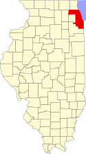
 Map of Illinois showing Cook County |
|||
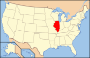
 Illinois's location in the United States |
|||
| Coordinates: 41°48′N 87°43′W / 41.800°N 87.717°WCoordinates: 41°48′N 87°43′W / 41.800°N 87.717°W | |||
| Country |
|
||
| State |
|
||
| Region | Northern Illinois | ||
| Metro area | Chicago Metropolitan | ||
| Incorporated | January 15, 1831 | ||
| Named for | Daniel Cook | ||
| County seat |
|
||
| Largest city |
|
||
| Incorporated municipalities |
135 (total)
|
||
| Government | |||
| • Type | County | ||
| • Body | Board of Commissioners | ||
| • Board President | Toni R. Preckwinkle (D) | ||
| • County Board | 17 commissioners | ||
| Area | |||
| • County | 1,635 sq mi (4,230 km2) | ||
| • Land | 945 sq mi (2,450 km2) | ||
| • Water | 690 sq mi (1,800 km2) | ||
| • Metro | 10,874 sq mi (28,160 km2) | ||
| Area rank | 6th largest county in Illinois | ||
| Highest elevation | 950 ft (290 m) | ||
| Lowest elevation | 580 ft (180 m) | ||
| Population (2010) | |||
| • County | 5,194,675 | ||
| • Estimate (2015) | 5,238,216 | ||
| • Rank |
1st largest county in Illinois 2nd largest county in U.S. |
||
| • Density | 5,530/sq mi (2,140/km2) | ||
| • Metro | 9,522,434 | ||
| Time zone | Central (UTC-6) | ||
| • Summer (DST) | Central (UTC-5) | ||
| ZIP Code prefixes | 600xx thru 608xx | ||
| Area codes | 224/847, 312/872, 773/872, 708 | ||
| Congressional districts |
1st, 2nd, 3rd, 4th, 5th, 6th, 7th, 8th, 9th 10th and 11th |
||
| FIPS code | 17-031 | ||
| GNIS feature ID | 1784766 | ||
| Interstates |
|
||
| U.S. Routes |
|
||
| State Routes |
|
||
| Airports |
Chicago O'Hare International |
||
| Waterways |
Lake Michigan – Chicago River |
||
| Amtrak stations |
Chicago Union Station |
||
| Public transit |
Chicago Transit Authority (CTA) Metra – Pace – South Shore Line |
||
| Website | www.cookcountyil.gov | ||
| Chicago, Illinois | ||||||||||||||||||||||||||||||||||||||||||||||||||||||||||||
|---|---|---|---|---|---|---|---|---|---|---|---|---|---|---|---|---|---|---|---|---|---|---|---|---|---|---|---|---|---|---|---|---|---|---|---|---|---|---|---|---|---|---|---|---|---|---|---|---|---|---|---|---|---|---|---|---|---|---|---|---|
| Climate chart () | ||||||||||||||||||||||||||||||||||||||||||||||||||||||||||||
|
||||||||||||||||||||||||||||||||||||||||||||||||||||||||||||
| ||||||||||||||||||||||||||||||||||||||||||||||||||||||||||||


