Indiana
| State of Indiana | |||||
|---|---|---|---|---|---|
|
|||||
| Nickname(s): The Hoosier State | |||||
| Motto(s): The Crossroads of America | |||||
| Official language | English | ||||
| Spoken languages | English, Spanish, other languages | ||||
| Demonym | Hoosier | ||||
|
Capital (and largest city) |
Indianapolis | ||||
| Largest metro | Indianapolis metropolitan area | ||||
| Area | Ranked 38th | ||||
| • Total | 36,418 sq mi (94,321 km2) |
||||
| • Width | 140 miles (225 km) | ||||
| • Length | 270 miles (435 km) | ||||
| • % water | 1.5 | ||||
| • Latitude | 37° 46′ N to 41° 46′ N | ||||
| • Longitude | 84° 47′ W to 88° 6′ W | ||||
| Population | Ranked 16th | ||||
| • Total | 6,633,053 (2016 est) | ||||
| • Density | 182/sq mi (70.2/km2) Ranked 16th |
||||
| • Median household income | $51,983 (35th) | ||||
| Elevation | |||||
| • Highest point |
Hoosier Hill 1,257 ft (383 m) |
||||
| • Mean | 700 ft (210 m) | ||||
| • Lowest point | Confluence of Ohio River and Wabash River 320 ft (97 m) |
||||
| Before statehood | Indiana Territory | ||||
| Admission to Union | December 11, 1816 (19th) | ||||
| Governor | Eric Holcomb (R) | ||||
| Lieutenant Governor | Suzanne Crouch (R) | ||||
| Legislature | General Assembly | ||||
| • Upper house | Indiana Senate | ||||
| • Lower house | Indiana House of Representatives | ||||
| U.S. Senators |
Todd Young (R) Joe Donnelly (D) |
||||
| U.S. House delegation | 7 Republicans, 2 Democrats (list) |
||||
| Time zones | |||||
| • 80 counties | Eastern: UTC −5/−4 | ||||
| • 12 counties in Evansville Metro Area, Gary Metro Area For more information, see Time in Indiana |
Central: UTC −6/−5 | ||||
| ISO 3166 | US-IN | ||||
| Abbreviations | IN, Ind. | ||||
| Website | www |
||||
| Indiana state symbols | |
|---|---|

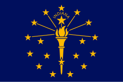
The Flag of Indiana
|
|

The Seal of Indiana
|
|
| Living insignia | |
| Bird | Cardinal |
| Fish | Largemouth Bass |
| Flower | Peony |
| Tree | Tulip tree |
| Inanimate insignia | |
| Beverage | Water |
| Colors | Blue and gold |
| Firearm | Grouseland Rifle |
| Food | Sugar cream pie |
| Mineral | Coal |
| Motto | The Crossroads of America |
| Poem | "Indiana" |
| Rock | Salem Limestone |
| Ship | USS Indianapolis (4), USS Indiana (4) |
| Soil | Miami |
| Song | official "On the Banks of the Wabash, Far Away" unofficial "Back Home Again in Indiana" |
| Sport | Basketball |
| State route marker | |
 |
|
| State quarter | |

Released in 2002
|
|
| Lists of United States state symbols | |
Indiana ![]() i/ɪndiˈænə/ is a U.S. state located in the midwestern and Great Lakes regions of North America. Indiana is the 38th largest by area and the 16th most populous of the 50 United States. Its capital and largest city is Indianapolis. Indiana was admitted to the United States as the 19th U.S. state on December 11, 1816.
i/ɪndiˈænə/ is a U.S. state located in the midwestern and Great Lakes regions of North America. Indiana is the 38th largest by area and the 16th most populous of the 50 United States. Its capital and largest city is Indianapolis. Indiana was admitted to the United States as the 19th U.S. state on December 11, 1816.
Before becoming a territory, varying cultures of indigenous peoples and historic Native Americans inhabited Indiana for thousands of years. Since its founding as a territory, settlement patterns in Indiana have reflected regional cultural segmentation present in the Eastern United States; the state's northernmost tier was settled primarily by people from New England and New York, Central Indiana by migrants from the Mid-Atlantic states and from adjacent Ohio, and Southern Indiana by settlers from the Southern states, particularly Kentucky and Tennessee.
...
Wikipedia


