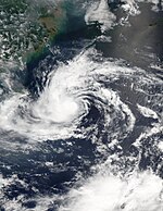
2002 Pacific typhoon season
| 2002 Pacific typhoon season |

Season summary map
|
| Seasonal boundaries |
| First system formed |
January 10, 2002 |
| Last system dissipated |
December 11, 2002 |
| Strongest storm |
|
| Name |
Fengshen |
| • Maximum winds |
185 km/h (115 mph)
(10-minute sustained) |
| • Lowest pressure |
920 hPa (mbar) |
| Seasonal statistics |
| Total depressions |
43 official, 1 unofficial |
| Total storms |
26 |
| Typhoons |
15 |
| Super typhoons |
8 (unofficial) |
| Total fatalities |
725 |
| Total damage |
$9.537 billion (2002 USD) |
| Related articles |
|
|
Pacific typhoon seasons
2000, 2001, 2002, 2003, 2004
|
| Tropical storm (JMA) |
| Tropical storm (SSHWS) |
|
|
| Duration |
January 9 – January 14 |
| Peak intensity |
75 km/h (45 mph) (10-min) 996 hPa (mbar) |
| Typhoon (JMA) |
| Category 5 super typhoon (SSHWS) |
|
|
| Duration |
February 26 – March 9 |
| Peak intensity |
175 km/h (110 mph) (10-min) 930 hPa (mbar) |
| Tropical depression (JMA) |
| Tropical depression (SSHWS) |
|
|
| Duration |
March 19 – March 25 |
| Peak intensity |
55 km/h (35 mph) (10-min) 1000 hPa (mbar) |
| Typhoon (JMA) |
| Category 5 super typhoon (SSHWS) |
|
|
| Duration |
May 14 – May 21 |
| Peak intensity |
175 km/h (110 mph) (10-min) 935 hPa (mbar) |
| Severe tropical storm (JMA) |
| Category 2 typhoon (SSHWS) |
|
|
| Duration |
June 4 – June 11 |
| Peak intensity |
110 km/h (70 mph) (10-min) 975 hPa (mbar) |
| Typhoon (JMA) |
| Category 3 typhoon (SSHWS) |
|
|
| Duration |
June 28 – July 6 |
| Peak intensity |
155 km/h (100 mph) (10-min) 945 hPa (mbar) |
| Typhoon (JMA) |
| Category 4 super typhoon (SSHWS) |
|
|
| Duration |
June 28 – July 11 |
| Peak intensity |
175 km/h (110 mph) (10-min) 930 hPa (mbar) |
| Typhoon (JMA) |
| Category 4 super typhoon (SSHWS) |
|
|
| Duration |
July 6 – July 16 |
| Peak intensity |
155 km/h (100 mph) (10-min) 945 hPa (mbar) |
| Severe tropical storm (JMA) |
| Tropical storm (SSHWS) |
|
|
| Duration |
July 7 – July 13 |
| Peak intensity |
95 km/h (60 mph) (10-min) 983 hPa (mbar) |
The 2002 Pacific typhoon season was an active season, with many tropical cyclones affecting Japan and China. Every month had tropical activity, with most storms forming from July through October. Overall, there were 44 tropical depressions declared officially or unofficially, of which 26 became named storms; of those, there were 15 typhoons, which is the equivalent of a minimal hurricane, while 8 of the 15 typhoon intensified into super typhoons unofficially by the JTWC.
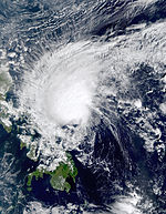
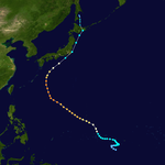
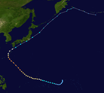
The season began early with the first storm, Tapah, developing on January 10, east of the Philippines. Two months later, Typhoon Mitag became the first super typhoon ever to be recorded in March. In June, Typhoon Chataan dropped heavy rainfall in the Federated States of Micronesia, killing 48 people and becoming the deadliest natural disaster in the state of Chuuk. Chataan later left heavy damage in Guam before striking Japan. In August, Typhoon Rusa became the deadliest typhoon in South Korea in 43 years, causing 238 deaths and $4.2 billion in damage.Typhoon Higos in October was the third strongest typhoon to strike Tokyo since World War II. The final typhoon of the season was Typhoon Pongsona, which was one of the costliest storms on record in Guam; it did damage worth $700 million on the island before dissipating on December 11.
The western Pacific basin covers the Pacific Ocean, north of the equator and west of the International Date Line. Storms that form east of the date line and north of the equator are called hurricanes; see 2002 Pacific hurricane season. Tropical Storms formed in the entire Northwest Pacific basin are assigned a name by the Japan Meteorological Agency (JMA). Tropical depressions in this basin have the "W" suffix added to their number when classified by the Joint Typhoon Warning Center (JTWC). Tropical depressions that enter or form in the Philippine area of responsibility are assigned a name by the Philippine Atmospheric, Geophysical and Astronomical Services Administration (PAGASA), which can result in the same storm having two names; in these cases both storm names are given below, with the PAGASA name in parentheses.
...
Wikipedia


