2000 Pacific typhoon season
| 2000 Pacific typhoon season |

Season summary map
|
| Seasonal boundaries |
| First system formed |
February 7, 2000 |
| Last system dissipated |
January 4, 2001 |
| Strongest storm |
|
| Name |
Bilis |
| • Maximum winds |
205 km/h (125 mph)
(10-minute sustained) |
| • Lowest pressure |
920 hPa (mbar) |
| Seasonal statistics |
| Total depressions |
51 |
| Total storms |
23 |
| Typhoons |
13 |
| Super typhoons |
4 (unofficial) |
| Total fatalities |
At least 467 |
| Total damage |
> $7.11 billion (2000 USD) |
| Related articles |
|
|
Pacific typhoon seasons
1998, 1999, 2000, 2001, 2002
|
| Typhoon (JMA) |
| Category 5 super typhoon (SSHWS) |
|
|
| Duration |
May 4 – May 12 |
| Peak intensity |
165 km/h (105 mph) (10-min) 930 hPa (mbar) |
| Tropical storm (JMA) |
| Tropical storm (SSHWS) |
|
|
| Duration |
May 17 – May 20 |
| Peak intensity |
85 km/h (50 mph) (10-min) 990 hPa (mbar) |
| Tropical depression (PAGASA) |
| Tropical depression (SSHWS) |
|
|
| Duration |
May 20 – May 22 |
| Peak intensity |
55 km/h (35 mph) (10-min) 1002 hPa (mbar) |
| Tropical depression (JMA) |
| Tropical depression (SSHWS) |
|
|
| Duration |
May 30 – June 1 |
| Peak intensity |
55 km/h (35 mph) (10-min) 1002 hPa (mbar) |
| Tropical depression (JMA) |
|
|
| Duration |
June 18 – June 18 |
| Peak intensity |
55 km/h (35 mph) (10-min) 1002 hPa (mbar) |
| Typhoon (JMA) |
| Category 4 typhoon (SSHWS) |
|
|
| Duration |
July 2 – July 8 |
| Peak intensity |
155 km/h (100 mph) (10-min) 940 hPa (mbar) |
| Typhoon (JMA) |
| Category 1 typhoon (SSHWS) |
|
|
| Duration |
July 3 – July 10 |
| Peak intensity |
140 km/h (85 mph) (10-min) 960 hPa (mbar) |
| Tropical depression (PAGASA) |
| Tropical depression (SSHWS) |
|
|
| Duration |
July 11 – July 13 |
| Peak intensity |
55 km/h (35 mph) (10-min) 1000 hPa (mbar) |
| Tropical depression (HKO) |
| Tropical depression (SSHWS) |
|
|
| Duration |
July 15 – July 17 |
| Peak intensity |
45 km/h (30 mph) (10-min) 996 hPa (mbar) |
The 2000 Pacific typhoon season has no official bounds; it ran year-round in 2000, but most tropical cyclones tend to form in the northwestern Pacific Ocean between May and November. These dates conventionally delimit the period of each year when most tropical cyclones form in the northwestern Pacific Ocean.
The scope of this article is limited to the Pacific Ocean, north of the equator and west of the international date line. Storms that form east of the date line and north of the equator are called hurricanes; see 2000 Pacific hurricane season. Tropical Storms formed in the entire west pacific basin are assigned a name by the Tokyo Typhoon Center. Tropical depressions in this basin have the "W" suffix added to their number. Tropical depressions that enter or form in the Philippine area of responsibility are assigned a name by the Philippine Atmospheric, Geophysical and Astronomical Services Administration or PAGASA. This can often result in the same storm having two names.
In storm information below, wind-speed advisories differ from the Joint Typhoon Warning Center (JTWC) to the JMA as the JTWC uses the United States' criteria of 1-minute means to designate maximum sustained winds, while the JMA uses the 10-minute mean wind criteria to designate tropical cyclone maximum sustained winds. This difference generally results in JTWC maximum winds appearing higher than the maximum winds described by the JMA for the same typhoon.
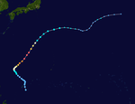
The first storm of the season started out as a tropical low near Palau on May 3, when the JTWC first gave the system a poor chance of formation. However within the next few hours the low quickly organized, and the next day the JMA recognized the low as a depression. Operationally it wasn't until May 5 that the JTWC issued its first warning for the newly formed depression. Drifting northwest the depression gradually organized into a tropical storm on May 6. It was given the name Asiang on May 6 by PAGASA and Damrey on May 7 by the JMA, respectively. At this time a weakening sub-tropical ridge was moving northward causing Damrey to move in a northeasterly direction. Damrey became a typhoon early on May 8 and soon thereafter satellite images began to show an eye forming at the center. During the next 24 hours Damrey quite steadily intensified, reaching winds of 130 mph (215 km/h) by May 9. The system became very symmetrical and small, allowing the typhoon to reach a peak intensity of 180 mph (290 km/h) and gusts as high as 220 mph late on May 9. Due to the compact structure of the typhoon it would only take twenty-four hours of high vertical wind shear, from a nearby high pressure, to reduce Damrey to a tropical storm. The convection continue to decrease around the LLCC and the system picked up in forward momentum under deteriorating environment. By May 12 Damrey became fully extra-tropical and eventually dissipated on May 16.
...
Wikipedia


