2001 Pacific typhoon season
| 2001 Pacific typhoon season | |
|---|---|
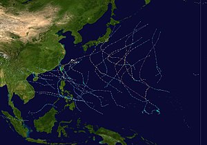
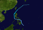
Season summary map
|
|
| Seasonal boundaries | |
| First system formed | February 17, 2001 |
| Last system dissipated | December 29, 2001 |
| Strongest storm | |
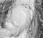
| Name | Faxai |
| • Maximum winds | 195 km/h (120 mph) (10-minute sustained) |
| • Lowest pressure | 915 hPa (mbar) |
| Seasonal statistics | |
| Total depressions | 45 |
| Total storms | 26 |
| Typhoons | 16 |
| Super typhoons | 3 (unofficial) |
| Total fatalities | 1287 total |
| Total damage | $2.3 billion (2001 USD) |
| Related articles | |
| Tropical depression (PAGASA) | |
| Tropical depression (SSHWS) | |
| Duration | February 17 – February 20 |
|---|---|
| Peak intensity | 55 km/h (35 mph) (10-min) 1004 hPa (mbar) |
| Tropical depression (PAGASA) | |
| Tropical depression (SSHWS) | |
| Duration | April 16 – April 18 |
|---|---|
| Peak intensity | 45 km/h (30 mph) (10-min) 1004 hPa (mbar) |
| Severe tropical storm (JMA) | |
| Tropical storm (SSHWS) | |
| Duration | May 9 – May 14 |
|---|---|
| Peak intensity | 95 km/h (60 mph) (10-min) 985 hPa (mbar) |
| Tropical depression (PAGASA) | |
| Duration | June 17 – June 19 |
|---|---|
| Peak intensity | 55 km/h (35 mph) (10-min) 1000 hPa (mbar) |
| Typhoon (JMA) | |
| Category 3 typhoon (SSHWS) | |
| Duration | June 19 – June 24 |
|---|---|
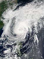
| Peak intensity | 120 km/h (75 mph) (10-min) 965 hPa (mbar) |
| Severe tropical storm (JMA) | |
| Category 1 typhoon (SSHWS) | |
| Duration | June 29 – July 2 |
|---|---|
| Peak intensity | 110 km/h (70 mph) (10-min) 970 hPa (mbar) |
| Severe tropical storm (JMA) | |
| Category 1 typhoon (SSHWS) | |
| Duration | July 1 – July 7 |
|---|---|
| Peak intensity | 110 km/h (70 mph) (10-min) 960 hPa (mbar) |
| Tropical storm (JMA) | |
| Tropical storm (SSHWS) | |
| Duration | July 8 – July 11 |
|---|---|
| Peak intensity | 75 km/h (45 mph) (10-min) 994 hPa (mbar) |
| Tropical depression (SSHWS) | |
| Duration | July 10 – July 11 |
|---|---|
| Peak intensity | 45 km/h (30 mph) (1-min) 1002 hPa (mbar) |
The 2001 Pacific typhoon season has no official bounds; it ran year-round in 2001, but most tropical cyclones tend to form in the northwestern Pacific Ocean between May and November. These dates conventionally delimit the period of each year when most tropical cyclones form in the northwestern Pacific Ocean.
The scope of this article is limited to the Pacific Ocean, north of the equator and west of the international date line. Storms that form east of the date line and north of the equator are called hurricanes; see 2001 Pacific hurricane season. Tropical Storms formed in the entire west pacific basin are assigned a name by the Tokyo Typhoon Center. Tropical depressions in this basin have the "W" suffix added to their number. Tropical depressions that enter or form in the Philippine area of responsibility are assigned a name by the Philippine Atmospheric, Geophysical and Astronomical Services Administration or PAGASA. This can often result in the same storm having two names.
In storm information below, wind-speed advisories differ from the Joint Typhoon Warning Center (JTWC) to the JMA as the JTWC uses the United States criteria of 1-minute mean to designate maximum sustained winds, while the JMA uses the 10-minute mean wind criterion to designate tropical cyclone maximum sustained gusts. This difference generally results in JTWC maximum winds appearing higher than the maximum winds described by the JMA for the same cyclone.
In the middle of February, a tropical depression moved across the Philippines.
From April 17 through April 21, a tropical depression persisted to the east of the Philippines.
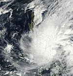
Tropical Storm Cimaron developed on May 9 and moved northward through the Philippines, dissipating on May 14.
A tropical disturbance formed northeast of the Philippines on June 15. It was classified as a Tropical Depression, receiving the name Darna on June 17. Pressure dropped to 4 millibars, but it failed to reach minimal tropical storm strength. Darna moved north on June 18 and dissipated to a low on June 19. No casualties were reported and damages were unknown.
...
Wikipedia

