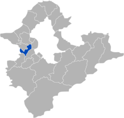
Xinzhuang District
|
Xinzhuang 新莊區 |
|
|---|---|
| District | |
| Xinzhuang District | |
 |
|
 Xinzhuang District in New Taipei City |
|
| Coordinates: 25°02′N 121°27′E / 25.033°N 121.450°ECoordinates: 25°02′N 121°27′E / 25.033°N 121.450°E | |
| Country | Taiwan |
| Region | Northern Taiwan |
| Special municipality | New Taipei |
| Area | |
| • Total | 19.74 km2 (7.62 sq mi) |
| Population (January 2016) | |
| • Total | 413,443 |
| • Density | 9,678.14/km2 (25,066.3/sq mi) |
| Time zone | CST (UTC+8) |
| Postal code | 242 |
| Website | http://web.archive.org/web/20120126062951/ http://www.xinzhuang.tpc.gov.tw:80/ |
| Xinzhuang District | |||||||||||||||
| Chinese | 新莊區 | ||||||||||||||
|---|---|---|---|---|---|---|---|---|---|---|---|---|---|---|---|
|
|||||||||||||||
| Transcriptions | |
|---|---|
| Standard Mandarin | |
| Hanyu Pinyin | Xīnzhuāng Qū |
| Bopomofo | ㄒㄧㄣ ㄓㄨㄤ ㄑㄩ |
| Tongyong Pinyin | Sinjhuang Cyu |
| Southern Min | |
| Hokkien POJ | Sin-chng-khu |
Xinzhuang District (Chinese: 新莊區; Hanyu Pinyin: Xīnzhuāng Qū; Tongyong Pinyin: Sinjhuang Cyu) is an inner city district in the western part of New Taipei in northern Taiwan. It has an area of 19.74 km2 (7.62 sq mi) and a population of 413,443 people (2016).
A former name of the area is Pulauan (Chinese: 武溜灣; Pe̍h-ōe-jī: Bú-liu-oan). On 15 January 1980, Xinzhuang was upgraded from an urban township to be a county-controlled city of Taipei County. On 25 December 2010, Taipei County was upgraded to New Taipei City, and Xinzhuang City was upgraded to a district.
The district is bordered by Wugu and Taishan to the north, Sanchong to the east, Banqiao and Shulin to the south, and Taoyuan City to the west.
...
Wikipedia
