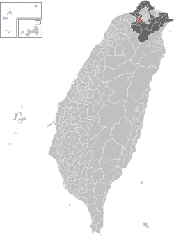
Banqiao District
|
Banqiao 板橋區 |
|
|---|---|
| District | |
| Banqiao District | |
 |
|
 Banqiao District in New Taipei City |
|
| Coordinates: 25°00′40″N 121°26′45″E / 25.01111°N 121.44583°ECoordinates: 25°00′40″N 121°26′45″E / 25.01111°N 121.44583°E | |
| Country | Taiwan |
| Special municipality | New Taipei City |
| Established | 1846 |
| Area | |
| • Total | 23.1368 km2 (8.9332 sq mi) |
| Population (January 2016) | |
| • Total | 554,008 |
| • Density | 24,000/km2 (62,000/sq mi) |
| Time zone | CST (UTC+8) |
| ZIP code | 220 |
| Area code(s) | 02 |
| Website |
www |
| Banqiao District | |||||||||||||||
| Traditional Chinese | |||||||||||||||
|---|---|---|---|---|---|---|---|---|---|---|---|---|---|---|---|
|
|||||||||||||||
| Transcriptions | |
|---|---|
| Standard Mandarin | |
| Hanyu Pinyin | Bǎnqiáo Qū |
| Wade–Giles | Pan3-ch'iao2 Ch'ü1 |
| Tongyong Pinyin | Bǎnciáo Cyu |
| Southern Min | |
| Hokkien POJ | Pán-kiô-khu |
Banqiao District (Chinese: 板橋區; pinyin: Bǎnqiáo Qū) is a district and the seat of New Taipei in northern Taiwan. It has the third highest population density in Taiwan. It was formerly the 22nd densest city in the world, with over 24,000 people per square km. Until the December 25, 2010 creation of New Taipei City, Banqiao (then transliterated as Panchiao) was an incorporated county-controlled city and the former seat of Taipei County.
In the early 20th century, Pankyo (Pankyu) was a walled city and said to be owned by a "very wealthy Chinaman" who had lived there "in feudal style", surrounded by armed retainers.
From 1920 to 1945, during Japanese rule, the area was administrated as Itahashi Town (板橋街?), Kaizan District, Taihoku Prefecture.
Banqiao originated from an urban township which was then upgraded to a county-controlled city as Panchiao City of Taipei County on 1 July 1972. The city was upgraded to a district as Banqiao District on 25 December 2010.
Banqiao is located in western part of the Taipei Basin of northern Taiwan, in the subtropical climate zone. Banqiao is surrounded by Taipei to the east, Sanchong to the north, Xinzhuang to the northwest, Shulin to the southwest, Tucheng to the south, and Zhonghe to the southeast. Banqiao is also bordered by two rivers, Xindian River to the northeast and Dahan River to the northwest.
...
Wikipedia
