Teseney
|
Teseney ተሰነይ tela sher |
|
|---|---|
| City | |
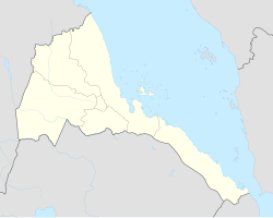
| Location in Eritrea | |
| Coordinates: 15°06′36″N 36°39′27″E / 15.11000°N 36.65750°E | |
| Country |
|
| Region | Gash-Barka |
| District | Teseney |
| Elevation | 919 m (3,015 ft) |
| Population (2012) | |
| • City | 4,815 |
| • Metro | 65,000 |
Teseney (Tigrinya: ተሰነይ?), also spelled Tessenei or Tesseney, is a market town in western Eritrea. It lies south-east of Kassala in Sudan, on the Gash River. The city was much fought over in the Eritrean War of Independence during which much of it was destroyed. After the war, Tessenei has become a governmental administrative center with customs and agricultural offices and a military base.
Teseney is located 45 kilometers from the Sudanese border and approximately 115 kilometers beyond Barentu. It is considered a frontier town on western Eritrea. The town is made up of people of various ethnic backgrounds. On the outskirts of Teseney to the north are a couple of hills from which there are exceptional views of the lowlands and mountains in Sudan. Also, farmers have been reporting of lions roaring in south of Teseney. In summer 2006, a young male lion was sighted and photographed, but since then, there has been no sighting and farmers do still report lions roars being echoed in the night. Monkeys and spotted hyenas form also part of Tessenei fauna, while acacia and Hyphaene thebaica palm locally known as Dom trees dominate its flora.
The name Tessenei with the diminutive of Seney, or Teseney, is not originally Tigrinya but Tigre, meaning “let it be nice to dwell”. It is also called Sabbot by its native local inhabitants. In 1929, it was called by the Italian colonizers the Village of Gasperini (named after the former colonial governor of Eritrea, a native of Treviso in Italy ).
...
Wikipedia

