Sha Tin Station
| MTR rapid transit station | |||||||||||||||||||||||||||

Platform 2
|
|||||||||||||||||||||||||||
| Chinese name | |||||||||||||||||||||||||||
| Chinese | 沙田 | ||||||||||||||||||||||||||
| Literal meaning | Sandy Field | ||||||||||||||||||||||||||
|
|||||||||||||||||||||||||||
| General information | |||||||||||||||||||||||||||
| Location | Sha Tin Station Circuit/Pai Tau Street, Sha Tin Sha Tin District, Hong Kong |
||||||||||||||||||||||||||
| Coordinates | 22°22′57″N 114°11′15″E / 22.3825°N 114.1875°ECoordinates: 22°22′57″N 114°11′15″E / 22.3825°N 114.1875°E | ||||||||||||||||||||||||||
| Owned by | Kowloon–Canton Railway Corporation | ||||||||||||||||||||||||||
| Operated by | MTR Corporation | ||||||||||||||||||||||||||
| Line(s) | |||||||||||||||||||||||||||
| Platforms | 4 (island platforms) | ||||||||||||||||||||||||||
| Connections | Bus, public light bus | ||||||||||||||||||||||||||
| Construction | |||||||||||||||||||||||||||
| Structure type | At-grade | ||||||||||||||||||||||||||
| Platform levels | 1 | ||||||||||||||||||||||||||
| Disabled access | Yes | ||||||||||||||||||||||||||
| History | |||||||||||||||||||||||||||
| Opened |
|
||||||||||||||||||||||||||
| Electrified | 1983 | ||||||||||||||||||||||||||
| Services | |||||||||||||||||||||||||||
|
|||||||||||||||||||||||||||
| Location | |||||||||||||||||||||||||||
|
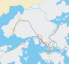
Location within the MTR system
|
|||||||||||||||||||||||||||
| Transcriptions | |
|---|---|
| Standard Mandarin | |
| Hanyu Pinyin | Shātián |
| Yue: Cantonese | |
| Yale Romanization | Sā Tìhn |
| Jyutping | saa1 tin4 |
Sha Tin (Chinese: 沙田) is a station on the East Rail Line of Hong Kong's Mass Transit Railway (MTR) system. The station is located in the town centre of Sha Tin.
The station was formerly on the main line of the Kowloon–Canton Railway (KCR), but since KCR's merger with the MTR, it belongs to the East Rail Line of the MTR.
Citylink Plaza, which has a footbridge link to New Town Plaza, is built on top of the station. The station serves two large bus termini with buses going to many places around Hong Kong (such as Sai Kung or Tung Chung). One is on an elevated surface, adjacent to the concourse level. The other is at ground level in New Town Plaza.
There are two island platforms for platforms 1 and 2, and platforms 3 and 4 respectively.
Trains normally stop at platforms 2 and 3. Platforms 1 and 4 are used in the following occasions:
...
Wikipedia

