Rueun
| Rueun | ||
|---|---|---|
| Former municipality of Switzerland | ||
 |
||
|
||
| Coordinates: 46°46.7′N 9°9′E / 46.7783°N 9.150°ECoordinates: 46°46.7′N 9°9′E / 46.7783°N 9.150°E | ||
| Country | Switzerland | |
| Canton | Graubünden | |
| District | Surselva | |
| Area | ||
| • Total | 11.58 km2 (4.47 sq mi) | |
| Elevation | 788 m (2,585 ft) | |
| Population (Dec 2011) | ||
| • Total | 414 | |
| • Density | 36/km2 (93/sq mi) | |
| Postal code | 7156 | |
| SFOS number | 3614 | |
| Surrounded by | Andiast, Flond, Ilanz, Obersaxen, Pigniu, Schnaus, Siat, Waltensburg/Vuorz | |
| Website |
www SFSO statistics |
|
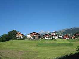
Rueun is a former municipality in the district of Surselva in the canton of Graubünden in Switzerland. On 1 January 2014 the former municipalities of Rueun, Castrisch, Ilanz, Ladir, Luven, Pitasch, Riein, Ruschein, Schnaus, Sevgein, Duvin, Pigniu and Siat merged into the new municipality of Ilanz/Glion.
Rueun is first mentioned in 765 as Ruane. Until 1943 Rueun was known as Ruis.
The blazon of the municipal coat of arms is Gules St. Andrew issuant holding a wooden saltire cross. The motif of St. Andrew comes from the local Church of St. Andrew, which was under the authority of Disentis Abbey.
Before the merger, Rueun had a total area of 11.6 km2 (4.5 sq mi). Of this area, 46% is used for agricultural purposes, while 43.7% is forested. Of the rest of the land, 4.4% is settled (buildings or roads) and the remainder (5.9%) is non-productive (rivers, glaciers or mountains).
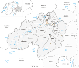
The former municipality is located in the Ruis sub-district of the Surselva district. It is located in the Vorderrhein valley.
Rueun had a population (as of 2011) of 414. As of 2008[update], 8.0% of the population was made up of foreign nationals. Over the last 10 years the population has decreased at a rate of -1.1%. Most of the population (as of 2000[update]) speaks Romansh (72.0%), with German being second most common (14.3%) and Serbo-Croatian being third ( 4.1%).
...
Wikipedia


