Pigniu
| Pigniu | ||
|---|---|---|
| Former municipality of Switzerland | ||
 |
||
|
||
| Coordinates: 46°48′N 9°06′E / 46.800°N 9.100°ECoordinates: 46°48′N 9°06′E / 46.800°N 9.100°E | ||
| Country | Switzerland | |
| Canton | Graubünden | |
| District | Surselva | |
| Area | ||
| • Total | 17.98 km2 (6.94 sq mi) | |
| Elevation | 1,301 m (4,268 ft) | |
| Population (Dec 2011) | ||
| • Total | 33 | |
| • Density | 1.8/km2 (4.8/sq mi) | |
| Postal code | 7156 | |
| SFOS number | 3613 | |
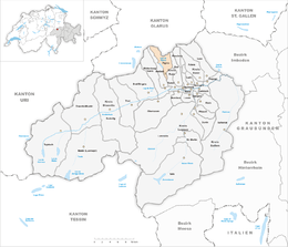
| Surrounded by | Andiast, Glarus Süd (GL), Rueun, Siat | |
| Website |
www SFSO statistics |
|
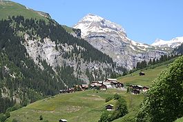
Pigniu (German: Panix) is a former municipality in the district of Surselva in the canton of Graubünden in Switzerland. Its official language is Romansh. On 1 January 2014 the former municipalities of Pigniu, Castrisch, Ilanz, Ladir, Luven, Pitasch, Riein, Ruschein, Schnaus, Sevgein, Duvin, Rueun and Siat merged into the new municipality of Ilanz/Glion.
Pigniu was probably settled from Andiast. The name Pingyow first appears in 1403. The German name Panix is first mentioned in 1522. Until 1984 Pigniu was known as Pigniu/Panix.
The Church of St. Valentin was dedicated in 1465 and was a popular goal of pilgrimages. Until 1667, Pigniu had its own parish.
On 7 October 1799, the Russian Army under command of Field Marshal Suvorov crossed the Pigniu pass.
The blazon of the municipal coat of arms is Gules St. Valentin clad Or and Argent holding his dexter in blessing and in sinister a crosier of the second standing above an ill Boy clad Sable. The coat of arms comes from the seal of a patron of the parish church.
Before the merger, Pigniu had a total area of 18.0 km2 (6.9 sq mi). Of this area, 36% is used for agricultural purposes, while 14.8% is forested. Of the rest of the land, 0.4% is settled (buildings or roads) and the remainder (48.8%) is non-productive (rivers, glaciers or mountains).
...
Wikipedia


