Pu'er Prefecture
|
Pu'er 普洱市 |
|
|---|---|
| Prefecture-level city | |
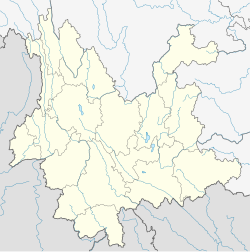
 Location of Pu'er City jurisdiction in Yunnan |
|
| Location of the city centre in Yunnan | |
| Coordinates: 22°47′N 100°58′E / 22.783°N 100.967°ECoordinates: 22°47′N 100°58′E / 22.783°N 100.967°E | |
| Country |
|
| Province | Yunnan |
| 530800 | |
| Admin HQ | Simao District |
| Admin units | |
| Area | |
| • Total | 45,385 km2 (17,523 sq mi) |
| Elevation | 1,306 m (4,285 ft) |
| Highest elevation | 3,306 m (10,846 ft) |
| Lowest elevation | 376 m (1,234 ft) |
| Population | |
| • Total | 2,360,000 |
| • Density | 52/km2 (130/sq mi) |
| Time zone | China Standard Time (UTC+8) |
| Postal code | 665000 |
| Area code(s) | 0879 |
| Licence plate prefixes | 云J |
| Website | PuErShi.gov.cn |
| Yunnan Statistics BureauYunnan Portal | |
| Pu'er City | |||||||
| Alternative Chinese name | |||||||
|---|---|---|---|---|---|---|---|
| Chinese | 普洱 | ||||||
| Postal | Puerh | ||||||
|
|||||||
| Second alternative Chinese name | |||||||
| Chinese | 思茅 (1950-2007) | ||||||
| Postal | Szumao (1950-2007) | ||||||
|
|||||||
| Transcriptions | |
|---|---|
| Standard Mandarin | |
| Wade–Giles | P'u3-erh3 |
| Transcriptions | |
|---|---|
| Standard Mandarin | |
| Wade–Giles | Szu1-mao2 |
Pu'er (Chinese: ) is a prefecture-level city in southern Yunnan Province, China. The name Pu'er dates back to 1729, but was changed to Simao (Chinese: 思茅; pinyin: Sīmáo) in 1950 after the Communist Revolution. In 2007, the original name of Pu'er was restored. This change had an effect on the size of the official Pu'er tea production area, a major regional product. The urban administrative center of Pu'er is Simao District, which is also the former name of the prefecture-level city itself. A major downturn in the price of tea in 2007 caused severe economic distress in the area. The price of Pu'er has since recovered and Pu'er tea still contributes much to the income of the area.
Association football is the most popular sport in Pu'er. The largest sports venue in the city is the 15,000-capacity Pu'er Stadium.
Pu'er is located in southern/southwestern Yunnan, on the lower reaches of the Mekong (known in Chinese as the Lancang), with the bordering prefectures being Yuxi to the northeast, Honghe to the east, Xishuangbanna to the south, Lincang to the northwest, and Dali and Chuxiong. It also shares borders with Vietnam (Điện Biên Province), Laos (Phongsaly Province), and Burma (Shan State), being the only prefecture in Yunnan to border all three countries. As with much of the province, mountainous terrain dominates its administrative area, covering 98.3%. Elevations range from 376 to 3,306 metres (1,234 to 10,846 ft).
...
Wikipedia

