Simao District
|
Simao 思茅区 |
|
|---|---|
| District | |
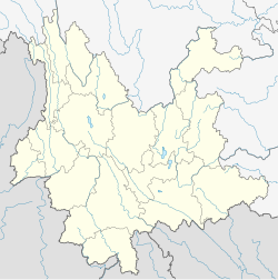
 Location of Simao District (pink) and Pu'er Prefecture (yellow) within Yunnan province of China |
|
| Location within Yunnan, China | |
| Coordinates: 22°46′51″N 100°58′30″E / 22.78083°N 100.97500°E | |
| Country | China |
| Province | Yunnan |
| Prefecture | Pu'er |
| 530802 | |
| Township divisions | 7 |
| Area | |
| • Total | 3,928 km2 (1,517 sq mi) |
| Elevation | 1,370.9 m (4,497.7 ft) |
| Population (2006) | |
| • Total | 255,500 |
| • Density | 65/km2 (170/sq mi) |
| Time zone | China Standard Time (UTC+8) |
| Postal code | 665000 |
| Area code(s) | 0879 |
| Website | www.simao.gov.cn |
|
1Yunnan Statistics Bureau [1] 2Puer Gov. [2] 3Yunnan Portal [3] |
|
| Simao District | |||||||
| Alternative Chinese name | |||||||
|---|---|---|---|---|---|---|---|
| Chinese | 思茅 | ||||||
| Postal | Szumao | ||||||
|
|||||||
| Transcriptions | |
|---|---|
| Standard Mandarin | |
| Wade–Giles | Szu1-mao2 |
Simao District (Chinese: 思茅区; pinyin: Sīmáo Qū; formerly known as Cuiyun District) is a district under the jurisdiction of Pu'er Prefecture, Yunnan Province, China. It is the seat of Puer Prefecture. Formerly both Simao and the surrounding region of Pu'er prefecture played a major role in the historic tea horse trade between Yunnan, Tibet and India, with Simao acting as the southern terminus or starting point for the transport of tea by mule caravan north to Dali, Lijiang and Lhasa. Tea remains a central crop and product of the region. In 2007, the city of Simao (思茅市) changed its name to Puer city (普洱市). By doing so, it has had an effect the size of the official Puer (普洱) tea production area.
In Simao District, the Bulang (population 272 as of 1990) live near the junction of the Xiaohei River 小黑江 and Lancang River 澜沧江, in the villages of Guanzhai 官寨, Tuanliangzi 团梁子, Mangbang 芒蚌, Mangba 芒坝, etc., in a total of 6 villages (Simao Prefecture Almanac 1993:480).
Simao Airport (IATA: SYM, ICAO: ZPSM).
Coordinates: 22°46′51″N 100°58′30″E / 22.78083°N 100.97500°E
...
Wikipedia

