Zhenyuan Yi, Hani and Lahu Autonomous County
| Zhenyuan County | |
|---|---|
| Autonomous county | |
| Chinese transcription(s) | |
| • Characters | 镇沅彝族哈尼族拉祜族自治县 |
| • Pinyin | Zhènyuán yízú hānízú lāhùzú Zìzhìxiàn |
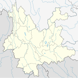
 Location of Zhenyuan County (pink) and Pu'er Prefecture (yellow) within Yunnan province of China |
|
| Location within Yunnan, China | |
| Coordinates: 23°51′N 100°59′E / 23.850°N 100.983°E | |
| Country | China |
| Province | Yunnan |
| Prefecture | Pu'er |
| 530825 | |
| Area | |
| • Total | 4,223 km2 (1,631 sq mi) |
| Elevation | 1,741 m (5,712 ft) |
| Population | |
| • Total | 201,526 |
| • Density | 48/km2 (120/sq mi) |
| Time zone | China Standard Time (UTC+8) |
| Postal code | 666500 |
| Area code(s) | 0879 |
| Website | http://www.pezy.gov.cn/ |
|
1Yunnan Statistics Bureau [1] 2Puer Gov. [2] 3Yunnan Portal [3] |
|
Zhenyuan Yi, Hani and Lahu Autonomous County (镇沅彝族哈尼族拉祜族自治县; pinyin: Zhènyuán yízú hānízú lāhùzú Zìzhìxiàn) is an autonomous county under the jurisdiction of Pu'er Prefecture, Yunnan Province, China.
The Zhenyuan County Almanac (1995:74-79) lists the following ethnic groups and locations. All population statistics, given in parentheses, are as of 1988.
Coordinates: 23°51′00″N 100°59′00″E / 23.85°N 100.9833°E
...
Wikipedia

