Lynwood, Illinois
| Lynwood, Illinois | |
| Village | |
| Official name: Village of Lynwood | |
| Motto: "A progressive, growing community of families and friends" | |
| Country | United States |
|---|---|
| State | Illinois |
| County | Cook |
| Coordinates | 41°31′35″N 87°32′53″W / 41.52639°N 87.54806°WCoordinates: 41°31′35″N 87°32′53″W / 41.52639°N 87.54806°W |
| Area | 5.54 sq mi (14 km2) |
| - land | 5.46 sq mi (14 km2) |
| - water | 0.08 sq mi (0 km2) |
| Population | 9,007 (2010) |
| Density | 1,649.6/sq mi (637/km2) |
| Founded | 1959 |
| Government | Village |
| Mayor | Eugene Williams |
| Timezone | CST (UTC-6) |
| - summer (DST) | CDT (UTC-5) |
| Postal code | 60411 |
| Area code | 708 |
|
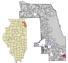
Location in Cook County and the state of Illinois.
|
|
|
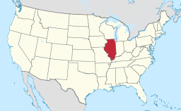
Location of Illinois in the United States
|
|
|
Website: www |
|
Lynwood is a village in Cook County, Illinois, United States. The population was 9,007 at the 2010 census.
Lynwood was founded in 1959. The village is bordered by Lansing to the north, Glenwood to the west, Ford Heights and Sauk Village to the south, and Munster and Dyer, Indiana, to the east. The Indiana state line borders the entire eastern edge of Lynwood. Lynwood is currently a mix of suburban neighborhoods with a substantial amount of remaining farmland.
Lynwood is located at 41°31′35″N 87°32′53″W / 41.52639°N 87.54806°W (41.526351, -87.548194).
According to the 2010 census, Lynwood has a total area of 5.547 square miles (14.37 km2), of which 5.47 square miles (14.17 km2) (or 98.61%) is land and 0.077 square miles (0.20 km2) (or 1.39%) is water.
As of the census of 2000, there were 7,377 people, 2,620 households, and 1,985 families residing in the village. The population density was 1,497.8 people per square mile (577.7/km²). There were 2,733 housing units at an average density of 554.9 per square mile (214.0/km²). The racial makeup of the village was 50.14% White, 45.40% African American, 0.23% Native American, 0.98% Asian, 1.55% from other races, and 1.71% from two or more races. Hispanic or Latino of any race were 4.57% of the population.
...
Wikipedia


