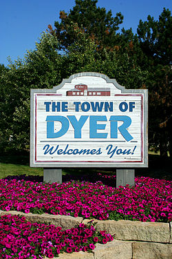
Dyer, Indiana
| Dyer, Indiana | |
|---|---|
| Town | |
 |
|
| Motto: Striving Higher in Dyer | |
 Dyer's location in Lake County (left) and the state of Indiana (right). |
|
| Coordinates: 41°30′1″N 87°30′44″W / 41.50028°N 87.51222°WCoordinates: 41°30′1″N 87°30′44″W / 41.50028°N 87.51222°W | |
| Country |
|
| State |
|
| County | Lake |
| Township | St. John |
| Settled | 1838 |
| Incorporated | January 24, 1910 |
| Government | |
| • Type | Town |
| • Body | Town Council |
| • President | Joseph M. Cinko (D, 1st) |
| • Vice-President | Mary Tanis (R, 4th) |
| • Members: | Jeffrey Decker (R, 2nd) Connee D. Trepton (D, 3rd) Debbie Astor (R, 5th) |
| • Clerk-Treasurer | Patricia A. Hawrot (D) |
| • Administrator | Rick Eberly |
| Area | |
| • Total | 6.10 sq mi (15.8 km2) |
| • Land | 6.10 sq mi (15.8 km2) |
| • Water | 0 sq mi (0 km2) |
| Elevation | 640 ft (200 m) |
| Population (2010) | |
| • Total | 16,390 |
| • Estimate (2013) | 16,277 |
| • Density | 2,687/sq mi (1,037/km2) |
| Standard of living (2008-12) | |
| • Per capita income | $35,020 |
| • Median home value | $197,500 |
| Time zone | Central (UTC-6) |
| • Summer (DST) | Central (UTC-5) |
| ZIP code | 46311 |
| Area code | 219 |
| FIPS code | 18-19270 |
| GNIS feature ID | 0433824 |
| Website | www.townofdyer.com |
Dyer is a town in St. John Township, Lake County, Indiana, United States. The population was 16,390 at the 2010 census.
This bedroom community lies in the Chicago Metropolitan Area.
Dyer placed 97th on the "100 Best Places to Live in the US" by CNN and Money Magazine in 2005. It was one of two Indiana municipalities to earn this distinction (the other being Fishers outside Indianapolis).
Dyer is located at 41°30′01″N 87°30′44″W / 41.500218°N 87.512161°W (41.500218, -87.512161).
Dyer borders Munster to the north, unincorporated St. John Township to the south, Schererville to the east, and Lynwood and Sauk Village in Illinois to the west. The Illinois state line comprises Dyer's entire western border. One of Dyer's neighborhoods, Briar Ridge, spans both Dyer and adjacent Schererville.
Dyer is built on mostly flat land with an exception being the steep sand ridge south of US Highway 30. This is the Glenwood Shoreline.
...
Wikipedia
