Lepontine Alps
| Lepontine Alps | |
|---|---|
| Lepontinische Alpen, Alpi Lepontine |
|

Monte Leone
|
|
| Highest point | |
| Peak | Monte Leone |
| Elevation | 3,553 m (11,657 ft) |
| Coordinates | 46°24′N 8°08′E / 46.400°N 8.133°E |
| Geography | |
| Countries | Switzerland and Italy |
| Canton, Region | |
| Range coordinates | 46°25′N 8°40′E / 46.42°N 8.67°ECoordinates: 46°25′N 8°40′E / 46.42°N 8.67°E |
| Parent range | Western Alps |
| Borders on | |
| Topo map | Swiss Federal Office of Topography swisstopo |
| Geology | |
| Orogeny | Alpine orogeny |
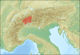
The Lepontine Alps (German: Lepontinische Alpen, French: Alpes lépontines, Italian: Alpi Lepontine) are a mountain range in the north-western part of the Alps. They are located in Switzerland (Valais, Ticino, Uri and Graubünden) and Italy (Piedmont and Lombardy).
The Simplon rail tunnel (from Brig to Domodossola) the Gotthard rail (from Erstfeld to Bodio) and Gotthard road tunnels (from Andermatt to Airolo) and the San Bernardino road tunnel are important transport arteries.
The eastern portion of the Lepontine Alps, from the St Gotthard Pass to the Splügen Pass, is sometimes named the Adula Alps.
The designation Lepontine Alps, derived from the Latin name of the Val Leventina, has long been somewhat vaguely applied to the Alpine ranges that enclose it, before being used for the whole range.
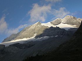
Following the line marking the division of the waters that flow into the Po from those that feed the Rhone or the Rhine, the main ridge of the Lepontine Alps describes a somewhat irregular curve, convex to the north, from the Simplon Pass to the Splugen Pass. With the single exception of the Monte Leone, overlooking the pass of the Simplon, the summits of this portion of the chain are much inferior in height to those of the neighbouring chains; but two peaks of the Adula group, culminating at the Rheinwaldhorn, exceed 11,000 feet (3,400 m) in height.
...
Wikipedia

