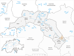
Bodio
| Bodio | ||
|---|---|---|

Visitors center of the Gotthard Base Tunnel in Bodio-Pollegio
|
||
|
||
| Coordinates: 46°23′N 8°55′E / 46.383°N 8.917°ECoordinates: 46°23′N 8°55′E / 46.383°N 8.917°E | ||
| Country | Switzerland | |
| Canton | Ticino | |
| District | Leventina | |
| Government | ||
| • Mayor | Sindaco | |
| Area | ||
| • Total | 6.44 km2 (2.49 sq mi) | |
| Elevation | 321 m (1,053 ft) | |
| Population (Dec 2015) | ||
| • Total | 1,037 | |
| • Density | 160/km2 (420/sq mi) | |
| Postal code | 6743 | |
| SFOS number | 5064 | |
| Surrounded by | Giornico, Personico, Pollegio, Semione, Sobrio | |
| Website |
http://www.bodio.ch SFSO statistics |
|
Bodio is a municipality in the district of Leventina in the canton of Ticino in Switzerland.
Bodio is first mentioned in 1227 as Boidi. During the Middle Ages, Bodio and the now abandoned village of Simbra (or Saimola) formed a Degagna in the Giornico area. During the reign of the cathedral of Milan over the three Ambrosian Valleys, in May and November the placita della Leventina meetings were held in Bodio. The Placita della Leventina, was a meeting of the Leventina valley used to administer justice and to discuss local issues. Until the 16th Century the village belonged to the parish of Giornico. It became a separate parish in 1567, and until 1602 Pollegio was part of the parish. The church of S. Stefano was first mentioned in 1227. Along with a large part of the village, it was destroyed by a landslide in the 15th Century. The current parish church dates from the 19th Century, the bell tower from 1779. The floods of 1817, 1829, 1834 and 1839 caused great damage in the village and a further flood of the Ticino river in 1868 caused 18 fatalities and destroyed some homes.
The town was important for timber transport on the Ticino river. Above Bodio, the logs were allowed to float freely down the river. At Bodio they were collected and rafted. In the so-called Fosso, a collection and delivery basin, the logs were collected and tied together to limit damage to the river embankments downstream.
Many residents emigrated from the municipality seeking work. Until the middle of the 19th Century, most of the emigrants went to Italy, with the exception of Glaser and Ofensetzer families, who mostly went to France. In 1876, a fifth of the former population (then 400 inhabitants) lived in the United States, primarily in California and Nevada.
The transformation of the community from a farming village to an industrial center is due to the construction of the Gotthard railway at the end of the 19th Century, and the use of water power from the Ticino river, which began in 1911 with the commissioning of the Biaschina-Zentrale powerplant. The availability of large amounts of energy at a low cost, and the presence of an important transport link (the train) induced various industries to settle in the region. This helped turn the area into an important industrial center of the Canton of Ticino. Around 1910, Swiss and German businesses opened in the community, including Diamant (grinding materials), the Gotthardwerke (metal alloys), the chemical plant Nitre (production of nitrogen derivatives) and two carbide factories. These industrial firms, which employed more than 1,000 workers (including many Italians), flourished thanks to the production of explosive materials during World War I. After the war, the industry declined due to the changes of production methods and high railway tariffs. The first industry to collapse was the granite industry, which employed about 150 people. On 21 July 1921, an explosion at the Nitre chemical plant claimed 15 lives, destroyed the factory and damaged neighboring buildings.
...
Wikipedia


