Rheinwaldhorn
| Rheinwaldhorn | |
|---|---|
| Adula | |

Rheinwaldhorn, February 2006
|
|
| Highest point | |
| Elevation | 3,402 m (11,161 ft) |
| Prominence | 1,337 m (4,386 ft) |
| Isolation | 35.1 km (21.8 mi) |
| Parent peak | Piz Kesch |
| Listing | Canton high point |
| Coordinates | 46°29′37″N 9°02′24″E / 46.49361°N 9.04000°ECoordinates: 46°29′37″N 9°02′24″E / 46.49361°N 9.04000°E |
| Geography | |
| Location |
Ticino, Graubünden Switzerland |
| Parent range | Lepontine Alps |
| Climbing | |
| First ascent | 1789 by Placidus a Spescha |
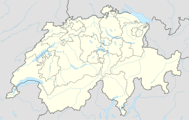
The Rheinwaldhorn (Italian: Adula) is the highest point in the Swiss canton of Ticino at 3,402 metres above sea level. It lies on the border between the cantons of Graubünden and Ticino, in the Adula massif, part of the St. Gotthard massif of the Lepontine Alps in southern Switzerland.
The mountain is known under different names, Rheinwaldhorn, Adula or Piz Valrhein. The group of the snowy peaks lying between the two principal branches of the Rhine were known in the Middle Ages by the names Mons Aquila or Mons Avium. From the Romansh form of the first comes the name Adula, which is used to designate the north-eastern portion of the Lepontine Alps. The German name "Rheinwaldhorn" comes from the Rheinwald region.
The Rheinwaldhorn is the culminating point of the eastern portion of the Lepontine Alps and the Adula group. In this area, the watershed between the Rhine and the Po river has no determinate direction, and exhibits a dislocated appearance. The peaks of the Adula form an irregular group, all the highest lying in a cluster not more five kilometres distant from the centre, which may be fixed as the foot of the Rheinwald Glacier. From the central group a considerable range extends due south more than 15 kilometres, between Val Blenio and Val Calanca, gradually diminishing in height. A parallel ridge connected with the main massif divides the Val Calanca from Val Mesocco; it surpasses but in few points the height of 9,000 feet. The northern ridge, longer but less regular than the first-mentioned, extends fully 20 kilometres, from the central group to the Piz Nadils over Sumvitg in the valley of the Vorderrhein.
Politically, the summit of the Rheinwaldhorn is split between two cantons and three municipalities. On the west side is the municipality of Blenio (Ticino) and on the east side are the municipalities of Vals and Hinterrhein (Graubünden).
...
Wikipedia

