Piz Kesch
| Piz Kesch | |
|---|---|
| Piz d'Es-cha | |

West view
|
|
| Highest point | |
| Elevation | 3,418 m (11,214 ft) |
| Prominence | 1,503 m (4,931 ft) |
| Isolation | 22.9 km (14.2 mi) |
| Parent peak | Mont Blanc |
| Listing | Ultra |
| Coordinates | 46°37′16.7″N 9°52′21.4″E / 46.621306°N 9.872611°ECoordinates: 46°37′16.7″N 9°52′21.4″E / 46.621306°N 9.872611°E |
| Geography | |
| Location | Graubünden, Switzerland |
| Parent range | Albula Alps, Rhaetian Alps |
| Climbing | |
| First ascent | 1846 by Johann Coaz, J. Rascher, C. Casper and J. Tscharner |
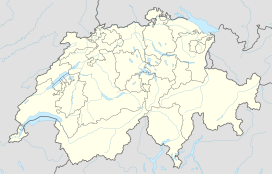
Piz Kesch (German) or Piz d'Es-cha (Rumantsch) is a peak in the Albula Alps of the Rhaetian Alps in Switzerland. At 3,418 metres (11,214 ft), it is the highest peak in the Albula Alps and the municipality of Bergün, Grisons.
The first ascent was made 1846 by J. Coaz, J. Rascher, C. Casper and J. Tscharner.
Piz Kesch is part of the mountain ridge which divides the southeastern Swiss Alps between the Rhine drainage basin (North Sea) and the Danube drainage basin (Black Sea). It is also the highest peak in the Eastern Alps north of the Inn River. On the north side lies the Porchabella Glacier.
West of Piz Kesch lies the Albula Pass (Pass d'Alvra in Rumantsch); to the north lies the valley of Davos, and to the south lies the Upper Engadine. On the foot of Piz Kesch in the Engadine lies the village of Madulain (1,694 m).
Two SAC's alpine huts lie close to Piz Kesch which are the Chamanna d'Es-Cha or Es-Cha Hütte (ca 2,594 m), and the Kesch-Hütte or Chamanna digl Kesch at (ca 2,625 m). The first lies on a 3-hour walk from Madulain, La Punt and Zuoz and about 1½ hours from the Albula Pass road. Kesch-Hütte lies 4½ hours from Bergün and can be reached as well from the Davos southern valleys of Sertig and Dischma or by a longer walk via Val Susauna coming from Cinuos-chel.
...
Wikipedia

