Simplon Pass
| Simplon Pass | |
|---|---|
 |
|
| Elevation | 2,005 m (6,578 ft) |
| Traversed by | Road |
| Location | Valais, Switzerland |
| Range | Alps |
| Coordinates | 46°15′6″N 8°2′0″E / 46.25167°N 8.03333°ECoordinates: 46°15′6″N 8°2′0″E / 46.25167°N 8.03333°E |
|
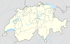
Location in Switzerland
|
|
The Simplon Pass (French: Col du Simplon; German: Simplonpass; Italian: Passo del Sempione) (2,005 m or 6,578 ft) is a high mountain pass between the Pennine Alps and the Lepontine Alps in Switzerland. It connects Brig in the canton of Valais with Domodossola in Piedmont (Italy). The pass itself and the villages on each side of it, such as Gondo, are in Switzerland. The Simplon Tunnel was built beneath the vicinity of the pass in the early 20th century to carry rail traffic between the two countries.
The lowest point of the col, and the lowest point on the watershed between the basins of the Rhone and the Po in Switzerland lies in marshland about 500 m (1,640 ft) west of the Simplon Pass settlement at an altitude of 1,994 m or 6,542 ft.
Rotelsee is a lake located near the pass at an elevation of 2,028 m (6,654 ft).
There are several great peaks around that can be climbed directly from the pass. These include Wasenhorn, Hubschhorn, Breithorn (Simplon), and Monte Leone.
There had been a locally used passage through the mountains here for several centuries, but the pass acquired international significance during the Napoleonic occupation. Between 1801 and 1805 the Simplon Road was constructed by the engineer Nicolas Céard at the direction of the emperor in order to transport artillery pieces through the pass between the Rhône valley and Italy. Since then, the pass has been usable by post carriages, replaced early in the twentieth century by post buses.
...
Wikipedia

