Kashgar
|
Kashgar (Kashi) 喀什市 • قەشقەر شەھرى |
|
|---|---|
| County-level city | |

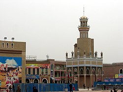
A minaret in Kashgar close to Id Kah mosque
|
|
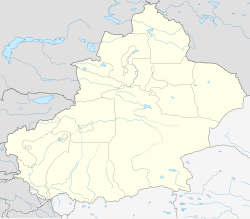
 Location (red) within Kashgar Prefecture |
|
| Location in Xinjiang | |
| Coordinates: 39°28′N 75°59′E / 39.467°N 75.983°ECoordinates: 39°28′N 75°59′E / 39.467°N 75.983°E | |
| Country | People's Republic of China |
| Region | Xinjiang |
| Prefecture | Kashgar |
| Area | |
| • County-level city | 555 km2 (214 sq mi) |
| • Metro | 2,818 km2 (1,088 sq mi) |
| Elevation | 1,270 m (4,170 ft) |
| Population (2010 census) | |
| • County-level city | 506,640 |
| • Metro | 819,095 |
| • Metro density | 290/km2 (750/sq mi) |
| Time zone | GMT+6 (de facto) |
| Postal code | 844000 |
| Area code(s) | 0998 |
| Website | www |
| Kashgar | |||||||||||

"Kashgar" in Chinese (top) and Uyghur Perso-Arabic (bottom) characters
|
|||||||||||
| Chinese name | |||||||||||
|---|---|---|---|---|---|---|---|---|---|---|---|
| Chinese | 喀什 | ||||||||||
|
|||||||||||
| Alternative Chinese name | |||||||||||
| Simplified Chinese | 喀什噶尔 | ||||||||||
| Traditional Chinese | 喀什噶爾 | ||||||||||
|
|||||||||||
| Uyghur name | |||||||||||
| Uyghur |
قەشقەر
|
||||||||||
|
|||||||||||
| Transcriptions | |
|---|---|
| Standard Mandarin | |
| Hanyu Pinyin | Kāshí |
| Wade–Giles | K'a1-shih2 |
| Transcriptions | |
|---|---|
| Standard Mandarin | |
| Hanyu Pinyin | Kāshígé’ěr |
| Wade–Giles | K'a1-shih2-ke2'-erh3 |
| Transcriptions | |
|---|---|
| Latin Yëziqi | Qeshqer |
| Yengi Yeziⱪ | Ⱪǝxⱪǝr |
| Siril Yëziqi | Қәшқәр |
| Uyghur IPA | [qæʃqær] |
Kashgar is an oasis city in Xinjiang and is the westernmost Chinese city, located near the border with Kyrgyzstan, Tajikistan, Afghanistan, and Pakistan. With a population of over 500,000, Kashgar has a rich history of over 2,000 years and served as a trading post and strategically important city on the Silk Road between China, the Middle East, and Europe.
Located historically at the convergence point of widely varying cultures and empires, Kashgar has been under the rule of the Chinese, Turkic, Mongol, and Tibetan empires. The city has also been the site of an extraordinary number of battles between various groups of people on the steppes.
Now administered as a county-level unit of the People's Republic of China, Kashgar is the administrative centre of its eponymous prefecture in the Xinjiang Uyghur Autonomous Region which has an area of 162,000 square kilometres (63,000 sq mi) and a population of approximately 3.5 million. The city's urban area covers 15 km2 (5.8 sq mi), though its administrative area extends over 555 km2 (214 sq mi). The city was made into a Special Economic Zone in 2010, the only city in western China with this distinction. It is considered a part of the China–Pakistan Economic Corridor.
The modern Chinese name is 喀什 (Kāshí), a shortened form of the longer and less-frequently used (simplified Chinese: 喀什噶尔; traditional Chinese: 喀什噶爾; pinyin: Kāshígé’ěr; Uyghur: قەشقەر). Ptolemy (AD 90-168), in his Geography, Chapter 15.3A, refers to Kashgar as “Kasi”. Its western and probably indigenous name is the Kāš ("rock"), to which the East Iranian -γar ("mountain"); cf. Pashto and Middle Persian gar/ġar, from Old Persian/Pahlavi girīwa ("hill; ridge (of a mountain)") was attached. Alternative historical Romanizations for "Kashgar" include Cascar and Cashgar.
...
Wikipedia

