Jordan Valley, Oregon
| Jordan Valley, Oregon | |
|---|---|
| City | |

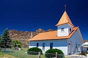
The Jordan Valley Methodist Church
|
|
| Motto: "Heart of the Owyhees" | |
 Location in Oregon |
|
| Coordinates: 42°58′35″N 117°3′19″W / 42.97639°N 117.05528°W | |
| Country | United States |
| State | Oregon |
| County | Malheur |
| Incorporated | 1911 |
| Government | |
| • Mayor | Marie Kershner |
| Area | |
| • Total | 2.08 sq mi (5.39 km2) |
| • Land | 2.08 sq mi (5.39 km2) |
| • Water | 0 sq mi (0 km2) |
| Elevation | 4,385 ft (1,337 m) |
| Population (2010) | |
| • Total | 181 |
| • Estimate (2012) | 178 |
| • Density | 87.0/sq mi (33.6/km2) |
| Time zone | Mountain (UTC-7) |
| • Summer (DST) | Mountain (UTC-6) |
| ZIP code | 97910 |
| Area code(s) | 458 and 541 |
| FIPS code | 41-37850 |
| GNIS feature ID | 1122534 |
| Website | www.cityofjordanvalley.com |
Jordan Valley is a city in Malheur County, Oregon, United States. It is part of the Ontario, OR–ID Micropolitan Statistical Area. The city lies along Jordan Creek, a tributary of the Owyhee River; the creek is named for a 19th-century prospector, Michael M. Jordan. The population was 181 at the 2010 census.
Jordan Valley was incorporated as a city in 1911.
Sacagawea's son Jean Baptiste Charbonneau is often said to be buried in Jordan Valley, as that is the closest incorporated city to Danner, the actual site of his burial.
In the center of town stands a pelota fronton, built in 1915 by Basque settlers, many of whom had been recruited from Spain to herd sheep. Their descendants are a noticeable presence today in Malheur County.
According to the United States Census Bureau, the city has a total area of 2.08 square miles (5.39 km2), all of it land.
Jordan Valley's most prominent landmark is the blunt plateau adjacent to town, named Pharmacy Hill.
Jordan Valley's main occupations are cattle ranching and sheep herding. People in those occupations typically live far from town on homesteads, but use Jordan Valley as their cultural and economic center. People within Jordan Valley primarily provide a number of services to tourists passing through on U.S. Route 95, which is the primary road from Boise, Idaho to Reno, Nevada.
...
Wikipedia
