Johnson County, Wyoming
| Johnson County, Wyoming | |
|---|---|

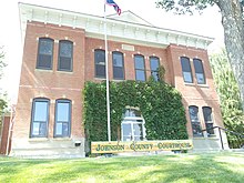
Johnson County Courthouse
|
|
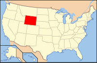
 Location in the U.S. state of Wyoming |
|
 Wyoming's location in the U.S. |
|
| Founded | 1881 |
| Seat | Buffalo |
| Largest city | Buffalo |
| Area | |
| • Total | 4,175 sq mi (10,813 km2) |
| • Land | 4,154 sq mi (10,759 km2) |
| • Water | 20 sq mi (52 km2), 0.5% |
| Population (est.) | |
| • (2015) | 8,585 |
| • Density | 2.1/sq mi (1/km²) |
| Congressional district | At-large |
| Time zone | Mountain: UTC-7/-6 |
| Website | www |
Johnson County is a county located in the north central part of the U.S. state of Wyoming. As of the 2010 census, the population was 8,569. The county seat is Buffalo.Kaycee is the only other incorporated town in the county.
Johnson County lies to the southeast of the Bighorn mountains along Interstate 25 and Interstate 90. The Powder River flows northward through eastern Johnson County.
Johnson County was created on December 8, 1875 as Pease County from parts of Albany, Carbon, and Sweetwater Counties. It was organized in 1881. The county was originally named for Dr. E. L. Pease of Uinta County. In 1879, the county was renamed Johnson, for E. P. Johnson, a Cheyenne attorney.
In 1888, Sheridan County was created from a portion of Johnson County. In 1890, Big Horn County was created from Johnson County along with land from Fremont County and Sheridan County. In 1911, the boundaries of Johnson County and adjacent Crook, Natrona and Weston Counties were adjusted to run along federal land survey lines.
In April 1892, Johnson County was the scene of the Johnson County War, a range war between large cattle outfits and small stockgrowers.
...
Wikipedia
