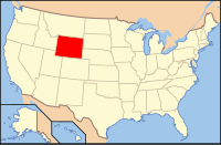
Uinta County, Wyoming
| Uinta County, Wyoming | |
|---|---|

Uinta County Courthouse
|
|
 Location in the U.S. state of Wyoming |
|
 Wyoming's location in the U.S. |
|
| Founded | 1869 |
| Named for | Uintah Mountains |
| Seat | Evanston |
| Largest city | Evanston |
| Area | |
| • Total | 2,088 sq mi (5,408 km2) |
| • Land | 2,081 sq mi (5,390 km2) |
| • Water | 6.3 sq mi (16 km2), 0.3% |
| Population (est.) | |
| • (2015) | 20,822 |
| • Density | 10/sq mi (4/km²) |
| Congressional district | At-large |
| Time zone | Mountain: UTC-7/-6 |
| Website | www |
Uinta County /juːˈɪntə/ is a county located in the U.S. state of Wyoming. As of the 2010 census, the population was 21,118. Its county seat is Evanston. It is northeast from the Utah state line.
Uinta County comprises the Evanston, WY Micropolitan Statistical Area.
Uinta County was created on December 1, 1869 by the legislature of the Wyoming Territory with its temporary seat located at Fort Bridger. Originally, it ran along the entire western border of Wyoming, including Yellowstone National Park. The county was named for Utah's Uinta Mountains, which are visible from many places in the county. The county was given its present boundaries in 1911 when Lincoln County was carved out of the northern part of Uinta County.
According to the U.S. Census Bureau, the county has a total area of 2,088 square miles (5,410 km2), of which 2,081 square miles (5,390 km2) is land and 6.3 square miles (16 km2) (0.3%) is water. It is the second-smallest county in Wyoming by area.
The 161 km wide western North American Fold and thrust belt extends from Alaska to Mexico, forming several northerly trending thrust faults in southwest Wyoming, including the Crawford, Absaroka and Hogsback (Darby), which formed from the Late Jurassic through the early Eocene. The Painter Reservoir Field was discovered in 1977 from the 407 m thick Nuggest Sandstone which forms an anticline structural trap in the hanging wall of the Absaroka thrust plate, at a depth of about 3 km.
...
Wikipedia
