Big Horn County, Wyoming
| Big Horn County, Wyoming | |
|---|---|
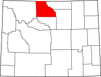
 Location in the U.S. state of Wyoming |
|
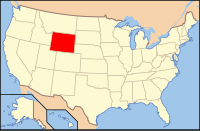
 Wyoming's location in the U.S. |
|
| Founded | 1897 |
| Seat | Basin |
| Largest town | Lovell |
| Area | |
| • Total | 3,159 sq mi (8,182 km2) |
| • Land | 3,137 sq mi (8,125 km2) |
| • Water | 22 sq mi (57 km2), 0.7% |
| Population (est.) | |
| • (2015) | 12,022 |
| • Density | 3.7/sq mi (1/km²) |
| Congressional district | At-large |
| Time zone | Mountain: UTC-7/-6 |
| Website | www |
Big Horn County is a county located in the U.S. state of Wyoming. As of the 2010 census, the population was 11,668. The county seat is Basin. It is south from the Montana state line.
Big Horn County was created by the legislature of Wyoming Territory on March 12, 1890 and organized in 1897. The county was created with lands ceded by Fremont County, Johnson County, and Sheridan County.
Big Horn County was named for the Big Horn Mountains which form its eastern boundary. Originally, the county included the entire Big Horn Basin.
In 1909, Park County, was detached from Big Horn County. In 1911, Hot Springs County, and Washakie County were detached from Big Horn County. At that point in time, the county got its present borders.
The current sheriff of Big Horn County is Ken Blackburn.
According to the U.S. Census Bureau, the county has a total area of 3,159 square miles (8,180 km2), of which 3,137 square miles (8,120 km2) is land and 22 square miles (57 km2) (0.7%) is water.
Big Horn County in Wyoming and Montana are one of ten pairs of counties and parishes in the United States with the same name to border each other across state lines. The others are Sabine (Texas and Louisiana), Union (Arkansas and Louisiana), Bristol (Massachusetts and Rhode Island), Kent (Maryland and Delaware), Escambia (Alabama and Florida), Pike (Illinois and Missouri), Teton (Idaho and Wyoming), Park (Montana and Wyoming), and San Juan (New Mexico and Utah).
...
Wikipedia
