Escambia County, Florida
| Escambia County, Florida | ||
|---|---|---|

Escambia County Courthouse
|
||
|
||
 Location in the U.S. state of Florida |
||
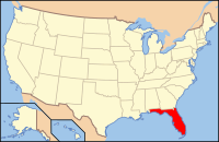
 Florida's location in the U.S. |
||
| Founded | July 21, 1821 | |
| Named for | Escambia River | |
| Seat | Pensacola | |
| Largest city | Pensacola | |
| Area | ||
| • Total | 875 sq mi (2,266 km2) | |
| • Land | 656 sq mi (1,699 km2) | |
| • Water | 218 sq mi (565 km2), 25.0% | |
| Population (est.) | ||
| • (2015) | 311,003 | |
| • Density | 453/sq mi (175/km²) | |
| Congressional district | 1st | |
| Time zone | Central: UTC-6/-5 | |
| Website | http://myescambia.com | |
Escambia County is the westernmost county in the U.S. state of Florida. As of the 2010 census, the population was 297,619. Its county seat is Pensacola and the County Administrator is Jack Brown.
Escambia County is included in the Pensacola-Ferry Pass-Brent, Florida Metropolitan Statistical Area. The county population has continued to increase as the suburbs of Pensacola and other cities have developed.
The area had been inhabited for thousands of years by indigenous peoples of varying cultures. Historic American Indian tribes at the time of European-American settlement were the Pensacola and Creek.
Escambia County was organized by European-Americans on July 21, 1821, after the United States bought East Florida and West Florida from Spain. It was named for the Escambia River. The name "Escambia" may have been derived from the Creek name Shambia, meaning "clearwater", or the Choctaw word for "cane-brake" or "reed-brake".
Created on the same date, Escambia and St. Johns counties were Florida's two original counties, covering the entire territory within modern state boundaries. The Suwannee River was the border between them, which follows a winding path from the northern border of the state to the Gulf of Mexico. Essentially, the Escambia county government had jurisdiction over the "panhandle" and "big bend" areas and St. Johns over the remainder of the entire state.
...
Wikipedia

