Sweetwater County, Wyoming
| Sweetwater County, Wyoming | |
|---|---|
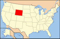
 Location in the U.S. state of Wyoming |
|
 Wyoming's location in the U.S. |
|
| Founded | 1867 |
| Named for | Sweetwater River |
| Seat | Green River |
| Largest city | Rock Springs |
| Area | |
| • Total | 10,491 sq mi (27,172 km2) |
| • Land | 10,427 sq mi (27,006 km2) |
| • Water | 64 sq mi (166 km2), 0.6% |
| Population (est.) | |
| • (2015) | 44,626 |
| • Density | 4.2/sq mi (2/km²) |
| Congressional district | At-large |
| Time zone | Mountain: UTC-7/-6 |
| Website | www |
Sweetwater County is a county located in the U.S. state of Wyoming. As of the 2010 census, the population was 43,806. Its county seat is Green River. In area, it is the largest county in the state. It is in the southwestern part of Wyoming, north of the Colorado-Utah state line.
Sweetwater County comprises the Rock Springs, WY Micropolitan Statistical Area.
Sweetwater County was originally created on December 17, 1867 as a county within the Dakota Territory. The county was derived from land that was previously part of Laramie County. The county was originally named Carter County for Judge W.A. Carter of Fort Bridger In 1869, the newly established legislature of the Wyoming Territory renamed the county for the Sweetwater River.
Also in 1869, Uinta County was organized with land ceded by Sweetwater County. Johnson County, originally named Pease County, was formed from parts of Sweetwater County and Carbon County in 1875. In 1884, Sweetwater County lost territory when Fremont County was created. Sweetwater County also lost territory when Carbon County was formed in 1886. At that point, the county achieved its present boundaries except for minor adjustments in 1909, 1911, and 1951.
South Pass City was the county seat from 1867 until 1873. At that time, the county seat was moved to Green River.
...
Wikipedia
