Ireland (island)
|
|
|---|---|

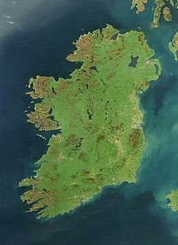
Satellite image of Ireland, October 2010
|
|
|
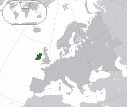
Location of Ireland (dark green)
in Europe (green & dark grey) |
|
| Geography | |
| Location | Western Europe |
| Coordinates | 53°25′N 8°0′W / 53.417°N 8.000°WCoordinates: 53°25′N 8°0′W / 53.417°N 8.000°W |
| Area | 84,421 km2 (32,595 sq mi) |
| Area rank | 20th |
| Coastline | 2,797 km (1,738 mi) |
| Highest elevation | 1,041 m (3,415 ft) |
| Highest point | Carrauntoohil |
| Administration | |
| Largest settlement | Dublin (pop. 553,165) |
| Country | Northern Ireland |
| Largest settlement | Belfast (pop. 333,000) |
| Demographics | |
| Demonym | Irish |
| Population | 6,378,000 (2011) |
| Population rank | 19th |
| Pop. density | 73.4 /km2 (190.1 /sq mi) |
| Languages | English, Irish, Ulster Scots |
| Ethnic groups | |
| Additional information | |
| Time zone | |
| • Summer (DST) | |
| Patron saints |
Saint Brigit Saint Colmcille Saint Patrick |
| Cities and towns by populations | ||||||
|---|---|---|---|---|---|---|
| # | Settlement | Urban Area Population | Metro population | |||
| 1 | Dublin | 1,110,627 | 1,801,040 Greater Dublin | |||
| 2 | Belfast | 333,000 |
Metropolitan area: 579,276 |
|||
| 3 | Cork | 198,582 | 300,0000 Cork Metro | |||
| 4 | Limerick | 102,164 | ||||
| 5 | Derry | 93,512 | ||||
| 6 | Galway | 76,778 | ||||
| 7 | Waterford | 65,928 | ||||
| 8 | Craigavon | 57,651 | ||||
| 9 | Drogheda | 38,578 | ||||
| 10 | Dundalk | 37,816 | ||||
in Europe (green & dark grey)
Ireland (![]() i/ˈaɪərlənd/; Irish: Éire [ˈeːɾʲə]; Ulster-Scots: Airlann pronounced [ˈɑːrlən]) is an island in the North Atlantic. It is separated from Great Britain to its east by the North Channel, the Irish Sea, and St George's Channel. Ireland is the second-largest island of the British Isles, the third-largest in Europe, and the twentieth-largest on Earth.
i/ˈaɪərlənd/; Irish: Éire [ˈeːɾʲə]; Ulster-Scots: Airlann pronounced [ˈɑːrlən]) is an island in the North Atlantic. It is separated from Great Britain to its east by the North Channel, the Irish Sea, and St George's Channel. Ireland is the second-largest island of the British Isles, the third-largest in Europe, and the twentieth-largest on Earth.
...
Wikipedia


