Hougang
| Hougang | ||||||||
|---|---|---|---|---|---|---|---|---|
| Planning Area and HDB Town | ||||||||
| Other transcription(s) | ||||||||
| • Chinese | 后港 | |||||||
| • Pinyin | Hòu Găng | |||||||
| • Malay | Hougang | |||||||
| • Tamil | ஹவ்காங் | |||||||
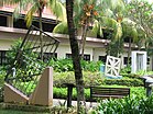
From top left to right: Hougang Central, Aerial view of Kovan, Kampong Lorong Buangkok, Flats along Hougang Avenue 4, Heritage Garden of the Institute of Mental Health, Panoramic view of Punggol Park
|
||||||||
| Location of Hougang within Singapore | ||||||||
| Coordinates: 1°22′18.4″N 103°53′35″E / 1.371778°N 103.89306°E | ||||||||
| Country |
|
|||||||
| Region |
|
|||||||
| CDCs | ||||||||
| Town councils |
|
|||||||
| Constituencies | ||||||||
| Government | ||||||||
| • Mayors |
Central Singapore CDC North East CDC South East CDC |
|||||||
| • Members of Parliament |
Aljunied GRC Ang Mo Kio GRC Hougang SMC Marine Parade GRC |
|||||||
| Area | ||||||||
| • Total | 13.93 km2 (5.38 sq mi) | |||||||
| • Residential | 3.67 km2 (1.42 sq mi) | |||||||
| Population (2015) | ||||||||
| • Total | 222,310 | |||||||
| • Density | 16,000/km2 (41,000/sq mi) | |||||||
| Demonym(s) |
Official
|
|||||||
| Postal district | 19 | |||||||
| Dwelling units | 51,646 | |||||||
| Projected ultimate | 72,000 | |||||||
Central Singapore CDC
North East CDC
South East CDC
Aljunied GRC
Ang Mo Kio GRC
Hougang SMC
Marine Parade GRC
Official
Hougang (Chinese: 后港, Tamil: ஹவ்காங்) is a planning area and residential town located in the North-East Region of Singapore. The town is the most populous in the region, being home to 222,310 residents. Hougang planning area is bordered by Sengkang to the north, Geylang to the south, Bedok to the southeast, Toa Payoh to the southwest, Paya Lebar to the east and Serangoon to the west.
Hougang is the pinyin version of Aū-káng, a Hokkien and Teochew name meaning "river end", as Hougang is located upstream or at the back of Sungei Serangoon. In the past, the name connoted the area stretching from the fifth milestone junction of Upper Serangoon Road and Upper Paya Lebar Road/Boundary Road to the seventh and a half milestone junction of Upper Serangoon Road and Punggol Road. The area just beyond the seventh milestone along Punggol Road was formerly considered part of Punggol but is now within Hougang Town and that section of Punggol Road is now Hougang Avenue 8, with Punggol Road starting further north.
Pig farming was carried out in Punggol, including the area of Punggol that is now part of Hougang Town. The last of these pig farmers were relocated by the late-1990s to flats built in Hougang. Today, Hougang is an HDB new town with over 40,000 housing units interspersed with pockets of private residential areas.
...
Wikipedia


