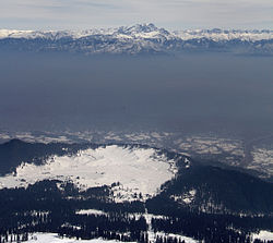
Gulmarg
|
Gulmarg گلمرگ |
|
|---|---|
| Hill station | |

View of Gulmarg from Gulmarg Gondola
|
|
| Coordinates: 34°03′N 74°23′E / 34.05°N 74.38°ECoordinates: 34°03′N 74°23′E / 34.05°N 74.38°E | |
| Country |
|
| State | Jammu and Kashmir |
| District | Baramulla |
| Elevation | 2,650 m (8,690 ft) |
| Population (2011) | |
| • Total | 1,965 |
| Languages | |
| • Official | Kashmiri, English, Urdu and Pahari |
| Time zone | IST (UTC+5:30) |
| PIN | 193403 |
Gulmarg is a town, a hill station, a popular skiing destination and a notified area committee in the Baramula district of the Indian state of Jammu and Kashmir. The town is situated in the Pirpanjal range in the western Himalayas.
Originally named Gaurimarg ("the fair one") by shepherds in honor of the Hindu goddess Parvati, the resort was renamed Gulmarg (“meadow of flowers”) by Sultan Yusuf Shah of the Chak Dynasty who frequented the place with his queen Habba khatoon in the 16th century. Wild flowers of 21 different varieties were collected by the Mughal emperor Jahangir for his gardens in Gulmarg. In the 19th century, British civil servants started using Gulmarg as a retreat to escape summers in North Indian plains. Hunting and golfing were their favorite pastime and three golf courses were established in Gulmarg including one exclusively for women. One of the three golf courses established survives to the present day and at an altitude of 2,650 metres (8,690 ft) is the world's highest golf course. In 1927, British established a ski club in Gulmarg and two annual ski events were hosted one each during Christmas and Easter. Central Asian explorer Aurel Stein also visited Gulmarg during this period.
After the end of London colonial rule, Gulmarg became a part of the independent princely state of Jammu and Kashmir. To ensure the accession of the princely state, Pakistan planned an invasion of the state called Operation Gulmarg. One of the routes used by the invading militia of Pathan tribesmen, armed and supported by Pakistani regular troops, passed through the Haji Pir pass and Gulmarg onto the state capital Srinagar. Gulmarg fell to the invading army, but the Indian army led by the 1 Sikh Regiment, which had been airlifted to Srinagar only after the Dogra ruler of the state Maharaja Hari Singh had signed an Instrument of Accession with India on 26 October 1947, successfully defended the outskirts of Srinagar. Thereafter, Indian counterattack pushed the tribesmen backwards and many towns including Gulmarg were recaptured. In 1948, Indian Army established a ski school in Gulmarg which later became the High Altitude Warfare School of the Indian army specializing in snow–craft and winter warfare. On 1 January 1949, the war ended under UN supervision and a Ceasefire line (CFL), which was rechristened the Line of Control (LOC) by the Shimla Agreement of 1972, came into being close to Gulmarg.
...
Wikipedia


