Cumberland County, Virginia
| Cumberland County, Virginia | ||
|---|---|---|

Cumberland County Courthouse
|
||
|
||
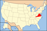
 Location in the U.S. state of Virginia |
||
 Virginia's location in the U.S. |
||
| Founded | 1749 | |
| Named for | William Augustus, Duke of Cumberland | |
| Seat | Cumberland | |
| Largest town | Farmville | |
| Area | ||
| • Total | 300 sq mi (777 km2) | |
| • Land | 297 sq mi (769 km2) | |
| • Water | 2.3 sq mi (6 km2), 0.8% | |
| Population (est.) | ||
| • (2015) | 9,719 | |
| • Density | 32/sq mi (12/km²) | |
| Congressional district | 5th | |
| Time zone | Eastern: UTC-5/-4 | |
| Website | www |
|
Cumberland County is a county located in the Commonwealth of Virginia. As of the 2010 census, the population was 10,052. Its county seat is Cumberland.
Cumberland County was established in 1749 from Goochland County. The county is named for William Augustus, Duke of Cumberland, second son of King George II of Great Britain. Cumberland County was also home to the Fleming family, which included Judge John Fleming and his son Judge William Fleming.
From 1749 until the eastern portion was detached to form Powhatan County in 1777, Mosby Tavern served as the county courthouse. The tavern subsequently became known as "Old Cumberland Courthouse." In 1778 the narrow triangular area bordering the southern bank of the James River was annexed from Buckingham County.
According to the U.S. Census Bureau, the county has a total area of 300 square miles (780 km2), of which 297 square miles (770 km2) is land and 2.3 square miles (6.0 km2) (0.8%) is water.
This rural county suffered a long decline in population from 1880 to 1970, as the number of workers needed for agriculture was reduced through mechanization. Since then its population has grown, reaching a peak in 2010 nearly equal to its 19th-century high.
As of the census of 2000, there were 9,017 people, 3,528 households, and 2,487 families residing in the county. The population density was 30 people per square mile (12/km²). There were 4,085 housing units at an average density of 14 per square mile (5/km²). The racial makeup of the county was 60.37% White, 37.44% Black or African American, 0.18% Native American, 0.35% Asian, 0.59% from other races, and 1.06% from two or more races. 1.66% of the population were Hispanic or Latino of any race.
...
Wikipedia

